

Kenya operates one of the most structured and forward-leaning drone regimes on the continent. The Kenya Civil Aviation Authority (KCAA) regulates the sector under the Civil Aviation (Unmanned Aircraft Systems) Regulations 2020, a clear, risk-based framework, and Kenya was an early mover on beyond-visual-line-of-sight approvals most visibly through medical-delivery operations that now reach hospitals across the country. For Kenyan organisations, that regulatory maturity converts directly into commercial opportunity.
The demand base is broad and deep: agriculture and horticulture across the Rift Valley and central highlands, wildlife conservation across the reserves and conservancies, an infrastructure programme centred on Nairobi and Mombasa, and utilities that span long, remote corridors. Each creates repeatable, revenue-generating drone work provided the fleet is genuine, compliant and properly supported.
What separates a productive fleet from an idle one is the support around it: correct platform selection, clean registration and airworthiness paperwork, trained and licensed pilots, and a reliable service pathway. Aerosmart Africa is built around that full lifecycle rather than a single sale, which is why Kenyan estates, survey firms, conservancies and county units treat us as a long-term partner.
Aerosmart Africa supplies the complete DJI range into Kenya as an authorised DJI Enterprise and DJI Agriculture dealer, with delivery to Nairobi, Mombasa, Nakuru and nationwide, KCAA regulatory guidance, and on-site training across the country.
Agriculture and Horticulture: Agriculture anchors Kenya's economy, from smallholders to large tea, coffee, flower and horticulture estates in Kiambu, Nakuru, Nyeri and the Rift Valley. Agriculture drones spray and spread with precision, map crop health, and help agronomists catch stress, disease and irrigation faults early, protecting export-grade yields while cutting input costs and manual labour.
Conservation and Wildlife Protection: Kenya's conservancies and reserves use drones for anti-poaching patrols, wildlife counts, and habitat mapping across vast terrain no vehicle patrol covers systematically. Thermal payloads extend monitoring into the low-light hours when threats peak, subject to the special permits that apply in game reserves.
Survey, Mapping and Construction: RTK mapping drones produce orthomosaics, elevation models and volumetric measurements for Kenya's roads, rail, real estate and quarrying around Nairobi, Mombasa and Kisumu, replacing slow, costly ground survey with fast, accurate aerial data.
Utilities and Energy: Power, water and telecom operators inspect transmission lines, towers, solar farms, dams and pipelines with high-zoom and thermal payloads, cutting downtime and keeping crews out of hazardous positions across long spans.
Health and Cargo Logistics: Building on Kenya's established medical-delivery record, cargo platforms carry samples, blood and supplies across terrain where road access is slow, opening logistics use cases for counties and health networks.
Media, Tourism and Real Estate: Kenya's film, tourism-marketing and property sectors generate steady demand for aerial cinematography on compact camera platforms, from coastal resorts to Nairobi developments.
Drone operations in Kenya are administered by the Kenya Civil Aviation Authority (KCAA) under the Civil Aviation (Unmanned Aircraft Systems) Regulations 2020—one of the clearer category-based systems in Africa. The summary below is practical guidance, not legal advice; confirm current requirements with the KCAA or through Aerosmart's regulatory brief.
Registration for All Drones: Every drone must be registered with the KCAA; Kenya does not exempt sub-250g aircraft. Registration issues a certificate and a unique Kenyan registration mark (in the 5Y- format) that must be affixed to the drone before flight.
Operational Categories: Operations are classed by risk. Category A (low risk) requires registration and a flight permit; Category B adds a Remote Air Operator Certificate (ROC) and a licensed remote pilot; Category C (higher risk, including certain BVLOS) requires an operational safety-case approval.
Remote Pilot Licence (RPL): Non-recreational operation requires an RPL obtained through KCAA-approved training, with age, English-proficiency and medical requirements.
Remote Air Operator Certificate (ROC): Any operation for commercial activity, reward or hire requires an ROC from the Authority.
Certificate of Airworthiness: Registered drones require a current airworthiness certificate; for factory drones from approved manufacturers such as DJI, this is typically issued on submission of manufacturer documentation and a basic inspection.
Operating Limits: Maximum 400 ft above ground level; VLOS unless otherwise authorised; no flights within 50 m of people, vehicles or vessels not part of the operation; no night flying without authorisation; and a 5 km stand-off from airports. Game-reserve flights require special permits.
What Aerosmart provides: a written Kenya-specific regulatory brief covering registration, the 5Y- mark, airworthiness, RPL and ROC pathways, operational categories and airspace restrictions plus KCAA-compatible documentation with every purchase.
Explore DJI enterprise drones, autonomous stations, payloads, software and accessories available for organisations and authorised operators across Kenya.
| Category | Products |
|---|---|
|
Enterprise Drones
|
Matrice 400 · Matrice 350 RTK · Matrice 4 Series · Matrice 30T |
|
Autonomous Stations
|
DJI Dock 3 · DJI Dock 2 |
|
Cargo Drones
|
DJI FlyCart 30 · DJI FlyCart 100 |
|
Agriculture Drones
|
DJI Agras T100 · DJI Agras T50 · DJI Agras T25 · DJI Mavic 3 Multispectral |
|
Payloads
|
Zenmuse H30 Series · Zenmuse L2 · Zenmuse L3 · Zenmuse P1 · Zenmuse H20 Series · Zenmuse S1 · Zenmuse V1 |
|
Camera Drones
|
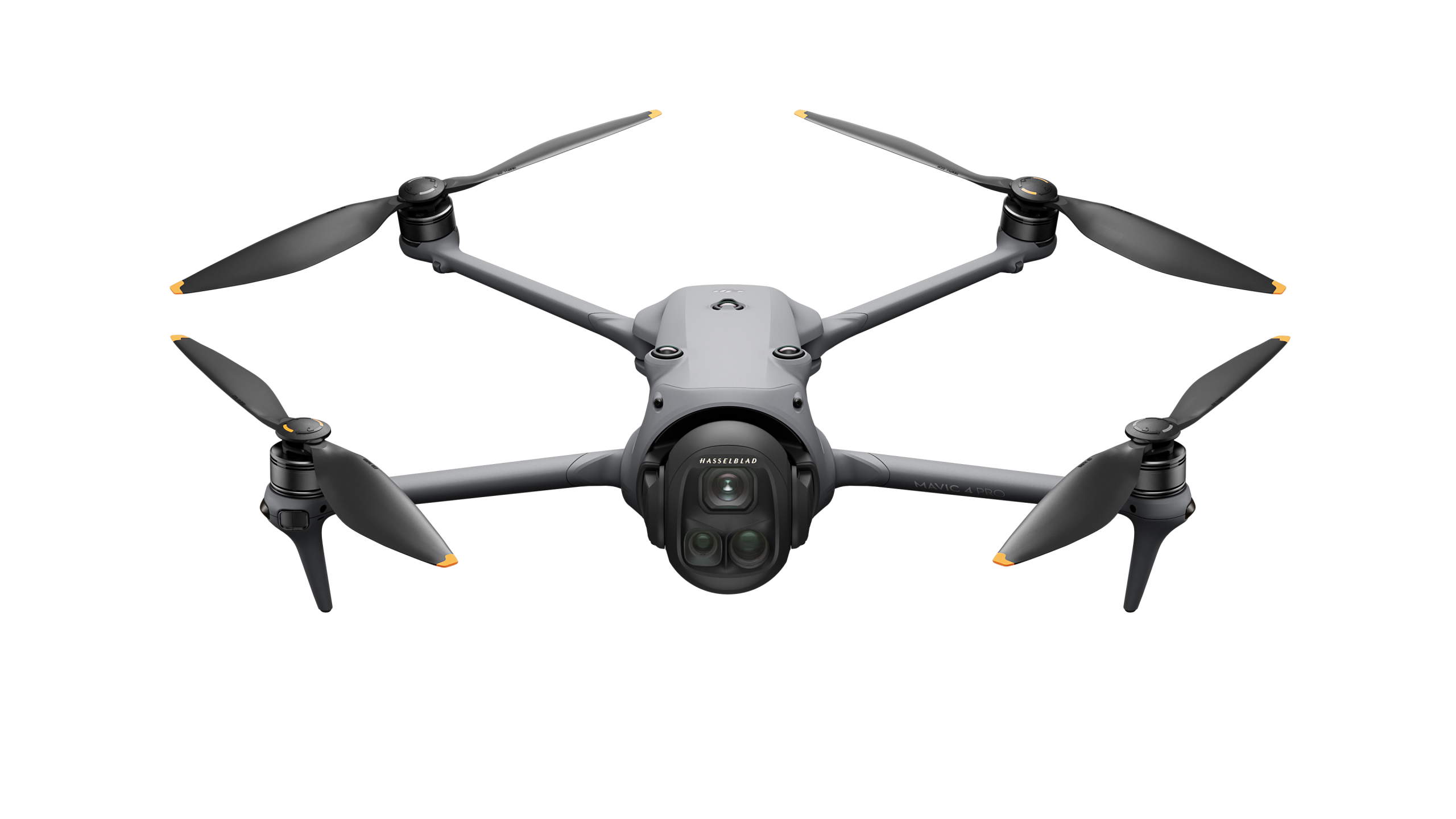
DJI Mavic 4 Pro · DJI Mini 5 Pro · DJI Air 3S · DJI Inspire 3 · DJI Avata 2 · DJI Neo 2 |
|
Software
|
DJI FlightHub 2 · DJI Terra · DJI Modify · PIX4Dmatic · PIX4Dsurvey |
|
Accessories
|
DJI D-RTK 3 · DJI D-RTK 2 · DJI O4 Ground Station · AP100 Parachute |
Platform choice follows the mission. For tea, horticulture and field crops, the Agras T50 handles large-area spraying and the T25 suits service providers and terraced smallholdings, while the Mavic 3 Multispectral maps crop health for variable-rate planning. For survey and construction, the Matrice 350 RTK with Zenmuse P1 delivers photogrammetry to roughly 3 cm with a D-RTK base station, and the Zenmuse L2 adds LiDAR where vegetation or complex geometry defeats photography. For conservation, the Matrice 30T and Matrice 4T bring compact thermal and zoom capability for patrols and counts. For persistent site monitoring, DJI Dock 3 paired with an enterprise airframe enables scheduled autonomous flights. Aerosmart's pre-sale consultation matches the airframe, payload and software to the outcome you are being paid to deliver. Where the target is Kenya's tea and horticulture estates, we also advise on battery logistics, spare-set rotation and charging setups for full-day operations far from a service centre, so a fleet stays airborne across a picking or spraying window rather than grounding on a flat pack. For coastal and lakeside work around Mombasa and Kisumu, we factor salt exposure and humidity into the maintenance schedule from day one.
Aerosmart supports operators nationwide, with concentrated demand in Nairobi (survey, construction, media, utilities), Mombasa (ports, logistics, infrastructure), Nakuru and the wider Rift Valley (agriculture and horticulture), and Eldoret, Kisumu, Nyeri, Thika, Meru and Kenya's conservancy regions. We deliver, configure, register and support fleets wherever your operation is based, and our training teams travel to site.
Aerosmart Academy delivers on-site training across Kenya—including Nairobi, Mombasa, Nakuru, Eldoret and the agricultural and conservancy regions—structured around KCAA certification requirements and delivered on genuine DJI enterprise platforms. Training covers flight operations, payload and mission setup, data workflows and the registration and licensing steps operators need to fly legally and productively.
A drone is only as valuable as the data it produces, and in Kenya most enterprise buyers are paying for outputs, not flights. Aerosmart supplies and configures the full DJI software chain so your fleet delivers finished results: FlightHub 2 for fleet management, mission planning and live operations; DJI Terra for photogrammetry, LiDAR point-cloud processing and volumetric calculation; and PIX4Dmatic and PIX4Dsurvey for large-scale mapping and survey-grade deliverables. For agriculture, multispectral captures from the Mavic 3 Multispectral convert into prescription maps that drive variable-rate application; for conservation and survey teams, orthomosaics, digital elevation models and 3D reconstructions export directly into the GIS and CAD tools your clients expect. We configure these workflows during onboarding so your operators produce client-ready outputs from the first project, rather than spending weeks discovering the processing pipeline on their own.
01 Authorised DJI Enterprise Dealer. Genuine products, manufacturer warranty, firmware support and KCAA-compatible documentation.
02 Kenya Delivery. Delivery to Nairobi, Mombasa, Nakuru and locations nationwide, with customs documentation support.
03 KCAA Regulatory Guidance. A written Kenya-specific regulatory brief covering registration, airworthiness, RPL and ROC requirements.
04 Sector Configuration. Agriculture, surveying, conservation and cargo operations require different systems. Aerosmart specifies the appropriate platform, payload and software workflow for each mission.
05 Autonomous Monitoring Setup. DJI Dock deployment for scheduled, repeatable site monitoring and coverage.
06 On-Site Training. Aerosmart Academy provides on-site operational and product training anywhere in Kenya, including estates and conservancies.
07 Service Coordination. Remote diagnostics, repair routing and DJI Care Enterprise claims are managed directly.
Aerosmart Africa is an authorised DJI Enterprise and DJI Agriculture dealer supplying across Kenya, with delivery to Nairobi, Mombasa, Nakuru and locations nationwide.
Yes. The KCAA requires all drones to be registered; there is no sub-250 g exemption. Registration issues a certificate and a unique 5Y-registration mark that must be displayed on the drone before flight.
Commercial operation for reward or hire requires a Remote Air Operator Certificate (ROC) from the KCAA, and the pilot must hold a Remote Pilot Licence (RPL) from KCAA-approved training. Exact requirements depend on your operational category A, B or C.
The DJI Agras T50 suits large tea, horticulture and field-crop spraying, while the DJI Agras T25 fits terraced smallholdings and service providers. The DJI Mavic 3 Multispectral maps crop health for variable-rate planning.
The DJI Matrice 30T or DJI Matrice 4T with thermal and zoom capability supports wildlife counts and patrols. Flights in game reserves require special KCAA permits, which Aerosmart can advise on.
The DJI Matrice 350 RTK with the Zenmuse P1 for photogrammetry to around 3 cm, or with the Zenmuse L2 for LiDAR, both with a D-RTK base station for centimetre accuracy.
Yes. Aerosmart Academy delivers on-site training anywhere in Kenya, including estates and conservancies, on genuine DJI enterprise platforms.
Yes. Aerosmart supports operators across Kenya, including Mombasa, Nakuru, Eldoret, Kisumu and conservancy areas, with delivery, configuration, registration guidance, training and service.
Contact Sales@aerosmartglobal.com with your application for a configuration and quotation.
Sales@aerosmartglobal.com · +254 726 999800 · Nairobi, Kenya

Fill in your details below and our team will get back to you
with a personalized quote.