
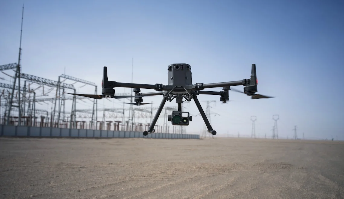
Terrestrial surveying measures individual points, and the software draws the surface between them. On flat and regular ground, that interpolation may be close to correct. On the varied terrain that African land surveys actually cover—undulating farmland, eroded slopes, riverine margins, rocky ground, and vegetated boundaries—the surface between measured points remains an assumption. The accuracy of every derived quantity depends on how accurate that assumption is.
Aerial surveying measures the complete surface. Every square metre can be captured at centimetre-level accuracy in a flight that covers in twenty minutes what a ground crew may take several days to measure. The terrain model is derived from measured data rather than interpolation, so calculated volumes, slopes, contours, and cross-sections inherit that accuracy.
For African survey businesses and government survey departments, the constraint has never been demand. It has been throughput. Drone surveying allows the same team to cover substantially more ground while maintaining the accuracy required by the final deliverable.
Aerosmart supplies, configures, and supports the complete DJI land survey ecosystem across 14+ African countries as an authorised DJI Enterprise dealer.
| Specification | Detail |
|---|---|
| Survey Platforms | Matrice 350 RTK · Matrice 400 · Matrice 4E |
| Photogrammetry | Zenmuse P1 · 45MP full-frame · 24/35/50 mm |
| LiDAR | Zenmuse L2 · Zenmuse L3 |
| RTK Base Stations | D-RTK 3 · D-RTK 2 |
| Horizontal Accuracy | 3 cm without ground control points |
| Vertical Accuracy | 5 cm with Zenmuse P1 · 3 cm at 120 m with Zenmuse L3 |
| Coverage | 3 km² per flight with Zenmuse P1 · Up to 100 km² per day with Zenmuse L3 |
| Outputs | Orthophoto · DSM · DTM · Contours · Point cloud |
| Processing | DJI Terra · PIX4Dmatic · PIX4Dsurvey |
| Vectorisation | PIX4Dsurvey · DXF · DWG · LandXML · SHP |
| Offline Processing | Complete processing pipeline with no internet connectivity required |
| Delivery Markets | 14+ African countries |
Topographic Survey
Complete site terrain models with contours at any specified interval,
derived from a measured surface rather than interpolation between
sampled points.
Boundary and Parcel Survey
High-resolution orthophotos at approximately 3 cm accuracy support
boundary identification, parcel delineation, and the documentation
required for land registration submissions.
Site Development Survey
Pre-construction terrain documentation, platform-level design
references, and drainage survey data for residential, commercial,
and industrial developments.
Route and Corridor Survey
Topographic surveys for roads, pipelines, powerlines, and drainage
corridors, with cross-sections extracted at specified design intervals.
Volume and Earthwork Survey
Cut-and-fill calculations between survey epochs or against design
surfaces at an accuracy suitable for payment certification.
Change Detection Survey
Repeat surveys quantify erosion, subsidence, deposition, and other
terrain changes over time.
Establishing ground control across a survey area requires a field crew, GNSS equipment, and hours of preparation before the drone can launch. Across many African locations, it may also require access to a national survey-control network that is incomplete, inaccessible, or unavailable.
A D-RTK 3 or D-RTK 2 base station changes that workflow. It establishes a reference position, broadcasts corrections to the aircraft throughout the flight, and allows every captured image to carry a centimetre-accurate position. Survey-grade data can therefore be captured from the first flight of the day.
Kenya's county spatial-planning surveys, Tanzania's village land certification, Uganda's systematic demarcation, Rwanda's continuing land-administration programmes, Ethiopia's rural land registration, and Ghana's parcel-documentation initiatives all operate across areas and timelines where terrestrial surveying alone may not deliver the required throughput.
Beyond formal land administration, the private survey market across African countries—including development-site surveys, agricultural estate mapping, mining-concession documentation, and infrastructure corridor surveys—faces the same capacity constraint. Drone surveying allows survey businesses to accept projects that may previously have been declined because of limited field capacity.
01 Authorised DJI Enterprise Dealer
Genuine products, original warranties, current firmware, and aviation
authority registration documentation.
02 Delivery Across 14+ Countries
Direct shipping, export documentation, and import duty guidance.
03 Coordinate System Configuration
Outputs are configured for your national survey framework so that data
can be imported without unnecessary coordinate-transformation rework.
04 Accuracy Consultation
Aircraft payloads and RTK base stations are matched to the actual
accuracy requirements of your deliverables.
05 Post-Sale Support and Servicing
Dubai-based repair, maintenance, and remote diagnostic support.
06 Survey Workflow Training
Training covers mission planning, RTK deployment, DJI Terra
processing, and PIX4Dsurvey vectorisation through Aerosmart Academy.
07 Complete System Configuration
Aircraft, payload, RTK base station, processing software, training,
and support are supplied as a complete working survey capability.
Using the Matrice 350 RTK with Zenmuse P1 and a D-RTK base station, drone surveying can achieve approximately 3 cm horizontal accuracy and 5 cm vertical accuracy without ground control points.
The Zenmuse P1 can cover approximately 3 km² per flight, with multiple flights possible in one day. The Zenmuse L3 mounted on the Matrice 400 can cover up to 100 km² per operating day.
No. RTK correction constrains the aircraft position throughout the flight. Ground control points may still be used for verification when the project specification requires independent accuracy checking.
Drone surveying can produce orthophotos, digital surface models, digital terrain models, contours, point clouds, and vectorised CAD deliverables through PIX4Dsurvey in DXF, DWG, SHP, and LandXML formats.
Photogrammetry cannot reliably capture the ground beneath dense canopy. LiDAR can penetrate gaps in vegetation, and the Zenmuse L3's multiple returns per pulse help generate ground-surface data beneath vegetated areas.
No. DJI Terra can process survey data entirely offline, allowing same-day deliverable production at remote field locations without reliable internet connectivity.
Yes. Aerosmart Academy delivers complete survey-workflow training on-site across supported African markets or at its Nairobi Academy.
Aerosmart supplies African markets including Kenya, Nigeria, Ethiopia, Ghana, Tanzania, Uganda, Rwanda, Zambia, Mozambique, Malawi, Zimbabwe, Namibia, Mali, Chad, Togo, Sierra Leone, The Gambia, Seychelles, the Republic of the Congo, the Democratic Republic of the Congo, and Côte d'Ivoire.

Fill in your details below and our team will get back to you with a personalised quote.