
Africa's agricultural sector employs more than 600 million people and contributes approximately 25% of the continent's GDP yet crop yields across most of Africa's farming systems remain far below the globally achieved potential for the same crop types, in similar climatic conditions, with similar soil types. The yield gap is not primarily a seed or fertiliser problem. It is an information problem. Farmers and agronomy service providers across Africa make crop management decisions when to spray, where to spray, how much to apply based on visual observation of the crop at walking pace rather than on the systematic, spatially complete crop health data that precision agriculture requires to target inputs where they are agronomically needed and withhold them where they are not.
DJI drone-based multispectral crop mapping produces the NDVI and NDRE data that closes this information gap providing the spatial crop health picture across the complete farm area that visual observation from ground level can never achieve, processed into the prescription maps that DJI Agras variable-rate application systems use to deliver inputs at the specific rates the crop health data prescribes for each field zone.
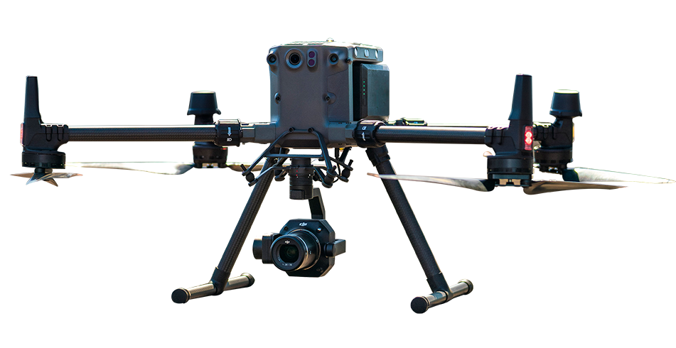
The DJI Mavic 3 Multispectral captures four channels of reflectance data Green, Red, Red Edge, and Near-Infrared across the crop canopy in a systematic grid mission. A calibrated sunlight sensor corrects for variable illumination conditions throughout the flight. RTK positioning georeferences every image precisely. DJI Terra processes the multispectral imagery into NDVI maps (overall crop health indicator), NDRE maps (nitrogen status indicator), and radiometrically calibrated reflectance maps suitable for repeat-visit comparison across the growing season.
The resulting NDVI map shows the complete spatial distribution of crop health across the field the high-NDVI green zones where the crop is performing well, and the low-NDVI yellow and red zones where stress, pest or disease pressure, nutrient deficiency, or soil condition is limiting crop performance. For a farmer or agronomist who has previously assessed the entire field by walking sampling routes and estimating overall crop health from what they could observe from footpath level, the NDVI map from a 20-minute drone flight over the same field is a revelation of spatial variation they had no previous way of knowing existed.
NDRE Normalised Difference Red Edge is the vegetation index most sensitive to canopy nitrogen content. For African commercial farming operations where nitrogen fertiliser is the largest single input cost in cereal, sugarcane, and vegetable crop production, knowing where nitrogen is deficient and where it is adequate before applying the next fertiliser dressing is directly cost-saving.
An NDRE map produced at the appropriate growth stage for the crop and fertiliser type enables the agronomist to identify the field zones requiring nitrogen top-dressing and those that do not quantifying the targeted versus blanket application difference in fertiliser quantity and cost. At commercial farm scale in Kenya, Ethiopia, Nigeria, or Ghana, this input efficiency is a direct production cost reduction that the drone survey investment pays back in a single season's adjusted fertiliser programme.
DJI Terra produces prescription maps directly from the NDVI and NDRE processed data defining the application rate zones across the field that the DJI Agras T50 or T100 uses for variable-rate spray missions. The prescription map is transferred to the Agras aircraft, which adjusts its spray flow rate automatically as it crosses the field applying more chemical in the stressed zones identified by the NDVI map and less in the healthy zones where the same application rate would be wasteful.
This data-to-action loop multispectral survey, NDVI processing, prescription map generation, variable-rate Agras application operates entirely within the DJI ecosystem that aerosmart supplies and supports across 14+ African countries, without requiring specialist GIS software, third-party agronomic prescribing services, or the data translation steps that mixed-vendor precision agriculture systems introduce.
Ethiopia's commercial farms: Coffee estates in Sidama and Yirgacheffe using NDVI mapping to identify disease hotspots before visible symptoms enable targeted fungicide application. Cereal farms in Oromia using NDRE maps to reduce blanket nitrogen fertiliser applications by 20–30%.
Kenya's floriculture and horticulture: Flower and vegetable farms in Naivasha and Thika where NDVI maps identify the irrigation distribution non-uniformity that causes localised crop stress in specific bed sections enabling irrigation system adjustment that improves yield uniformity without additional water consumption.
Nigeria's commercial maize belt: Northern Nigerian commercial maize production using NDVI early stress detection 10–14 days before visible symptoms appear giving the agronomist the intervention window where targeted fungicide or irrigation response can prevent yield loss that visible symptom appearance would confirm had already occurred.
Ghana's oil palm sector: NDRE nitrogen mapping in commercial oil palm estates identifying the palm rows where nitrogen uptake is lowest enabling targeted slow-release fertiliser placement that improves both individual palm yield and the uniformity of the estate's overall production.
Multispectral drones such as the DJI Mavic 3 Multispectral can map crop health across African farms using vegetation indices such as NDVI and NDRE. These maps help identify areas showing possible crop stress, nutrient deficiency, irrigation problems, pest pressure or disease symptoms. The resulting data can be processed into field maps that support targeted scouting, fertiliser planning and variable-rate treatment workflows.
NDVI stands for Normalised Difference Vegetation Index. It uses the difference between near-infrared and red-light reflectance to indicate vegetation vigour. Healthy plants generally reflect more near-infrared light, while stressed vegetation may reflect less. An NDVI map gives farmers a field-wide view of crop variability and helps them identify areas that may require closer ground inspection.
The DJI Mavic 3 Multispectral is suitable for crop-health mapping, vegetation-index generation and field scouting. It combines RGB and multispectral imaging with RTK positioning and an integrated sunlight sensor. For larger commercial farming programmes, platform selection should be based on field size, required ground resolution, flight time, processing workflow and the type of agricultural analysis required.

Fill in your details below and our team will get back to you
with a personalised quote.