
Road traffic collisions, major incidents and complex forensic scenes require investigators to create an accurate and complete spatial record before evidence is moved and the location is released. Traditional documentation methods, including tape measurements, total-station surveys and ground photography, can require personnel to move repeatedly through the scene and may extend the time needed to reopen a road or return an area to normal operations.
DJI enterprise drones can support this workflow by capturing overlapping aerial imagery for orthophotos, point clouds and 3D models. These outputs preserve the visible spatial relationships between vehicles, road markings, debris, skid marks, surrounding infrastructure and other documented features, allowing authorised investigators to review the scene after field operations have ended.
Collision-investigation and forensic teams may need to work on busy urban roads, high-speed corridors, remote highways and large scenes involving multiple vehicles or widely dispersed evidence. Extended closures can increase congestion and expose responders and road users to additional hazards, while large debris fields can be difficult to document completely with manual measurements alone.
Drone photogrammetry provides a repeatable overhead record of the visible scene. With an appropriate flight plan, positioning workflow and quality-control process, investigators can create a georeferenced dataset that supports measurements and visual analysis after the site has been cleared. Drone data should complement, not replace, established forensic photography, evidence handling, surveying and chain-of-custody procedures.
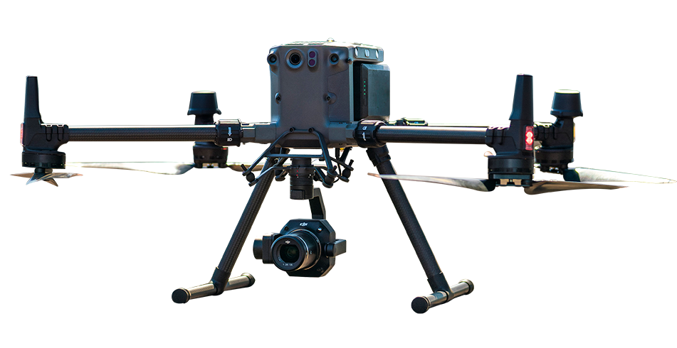
The DJI Matrice 350 RTK paired with the Zenmuse P1 is designed for professional photogrammetry missions. The Zenmuse P1 combines a 45 MP full-frame sensor with a global mechanical shutter, helping reduce motion-related image distortion during planned mapping flights.
When used with a properly configured RTK correction source, such as the D-RTK 3 Multifunctional Station or an approved network RTK service, the system can support centimetre-level positioning and high-accuracy mapping workflows. Final scene accuracy depends on flight altitude, image overlap, camera settings, RTK status, environmental conditions, processing parameters and independent validation using suitable control or check points.
The resulting orthophoto, point cloud and 3D model can help investigators examine vehicle positions, road geometry, debris distribution and other visible scene features. Measurements intended for formal reports, reconstruction calculations or evidentiary use should be validated and documented according to the applicable agency procedures and local legal requirements.
The DJI Matrice 4T is a portable multi-sensor aircraft suited to rapid situational assessment. Its integrated wide-angle, medium-telephoto, telephoto and thermal cameras can help response teams capture an early aerial overview before vehicles, debris or other scene elements are moved during rescue, recovery and traffic management operations.
Visible-light imagery can support orientation and overview documentation, while thermal imagery may help identify active heat sources or areas requiring further examination. Thermal observations must be interpreted carefully and should not be treated as standalone proof of vehicle movement, braking behaviour, injury timing or collision sequence.
DJI Terra can process compatible aerial imagery into 2D orthophotos, 3D models and point clouds. These outputs can support scene visualisation, forensic diagrams, measurements and export into compatible specialist analysis workflows.
DJI Terra is available with different licensing options, including offline-license configurations. Local processing requirements depend on the selected licence, software version, workstation specifications and project size. Teams operating in remote areas should confirm activation, hardware and offline-processing requirements before deployment.
Across Africa, collision-investigation teams may operate in environments where traffic density, mixed road use, limited diversion routes and long travel distances increase the operational impact of an extended road closure. Aerial documentation can help teams record large scenes efficiently while reducing unnecessary movement through evidence areas.
The same photogrammetry workflow can support other outdoor forensic and incident-documentation applications, including major property damage, disaster assessment, public-safety incidents and large outdoor crime scenes. Each mission must comply with local aviation, privacy, evidence-management and public-safety requirements.
| Application | Platform | Payload | Output |
|---|---|---|---|
| High-accuracy scene mapping |
DJI Matrice 350 RTK
|
Zenmuse P1 with RTK correction source | High-resolution orthophoto, point cloud and 3D model |
| Rapid initial documentation |
DJI Matrice 4T
|
Integrated multi-sensor camera system | Rapid visual overview and supporting thermal observations |
| Data processing |
DJI Terra
|
— | Orthophoto, point cloud and 3D model |
DJI enterprise drones can capture overlapping aerial images of collision scenes for processing into orthophotos, point clouds and 3D models. These outputs can preserve the visible positions of vehicles, skid marks, debris, road features and surrounding infrastructure within a spatially referenced record. Investigators can then review and measure validated scene data after the road has reopened.
A DJI Matrice 350 RTK paired with the Zenmuse P1 and a properly configured RTK correction source can support centimetre-level mapping workflows. The achieved accuracy is not a fixed value and depends on the flight plan, altitude, image overlap, camera settings, RTK quality, environmental conditions, processing workflow and independent quality checks. Measurements used for formal reconstruction or evidentiary purposes should be validated under the investigating organisation's approved procedures.
Capture time depends on the size and complexity of the scene, required ground resolution, airspace restrictions, weather, battery planning and safety procedures. A compact scene may be captured within tens of minutes, while larger or more detailed sites will require additional flight and processing time. Drone documentation can reduce field-measurement time in suitable conditions, but the scene should only be released after all required investigative and evidence-handling tasks are complete.

Fill in your details below and our team will get back to you with a personalised quote.