
Africa's climate and geography create an extensive and intensifying disaster-risk landscape. Mozambique's cyclone seasons—including Cyclone Idai in 2019 and Cyclone Kenneth only weeks later—have demonstrated the severe impact that Indian Ocean tropical cyclones can have on coastal settlements, river systems and road infrastructure. Ethiopia's highland rainy season generates flooding that can isolate communities, destroy bridges and displace large populations. Nigeria also experiences major flood events along the Niger and Benue rivers, while East Africa's drought-and-flood cycle can expose communities to two different disaster risks within the same year.
In each of these environments, the first operational challenge is obtaining accurate situational awareness. The speed and quality of aerial intelligence available during the first hours of an emergency can determine how effectively personnel, medical support and relief supplies are deployed. DJI enterprise drone systems from Aerosmart provide disaster management agencies with rapid aerial assessment, mapping, thermal observation, communication and cargo-delivery capabilities.
Much of Africa's seasonal flood risk occurs within known river systems, drainage basins and vulnerable communities. Disaster management authorities therefore require regular observation of the hydrological conditions that may indicate an approaching flood, including changing river levels, bank saturation, blocked channels, embankment damage and upstream catchment conditions.
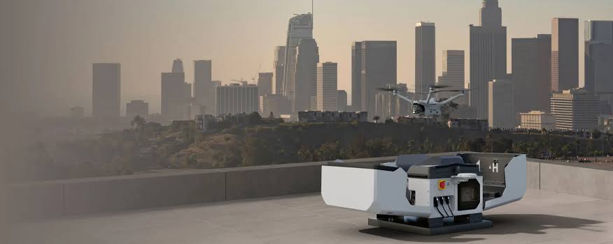
DJI Dock 3 autonomous stations positioned at strategic observation points along high-risk river systems can support scheduled aerial monitoring without requiring a flight crew to travel to every site each day. Recurring missions can establish a visual baseline and provide updated imagery to regional coordination teams, helping them identify significant changes and issue early warnings to at-risk communities.
Many African urban areas combine high population density with building stock of varying age, quality and resistance to cyclone or seismic damage. Drone-based aerial inspection using photogrammetry payloads such as the Zenmuse P1 can produce high-resolution imagery and 3D models for structural vulnerability assessment. These outputs can help authorities document dense informal settlements, inspect visible signs of structural distress and identify critical infrastructure whose failure could increase the impact of a future disaster.
Major flood and cyclone events can damage roads, bridges, communication networks and access routes across a wide area. During the initial response period, emergency organisations need reliable information about which roads remain passable, which bridges have failed, which settlements are accessible and where displaced or injured populations are concentrated.
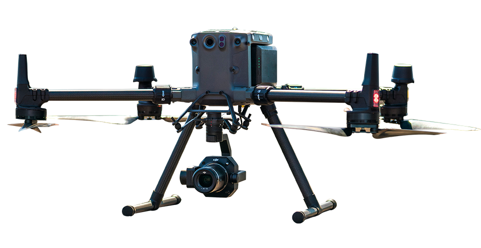
A DJI Matrice 400 equipped with compatible mapping payloads, such as the Zenmuse L2 or Zenmuse P1, can support rapid post-event aerial surveys of affected infrastructure. The collected data can be processed in DJI Terra to produce maps, point clouds and 3D models that support route planning and damage assessment. Offline processing workflows can also be valuable when internet connectivity is unavailable or unreliable within the disaster zone.
Seismic events can create building-collapse and structural-damage scenarios that require rapid assessment before rescue personnel and equipment are committed to specific locations. Aerial imagery and photogrammetric models can help emergency teams document collapsed structures, identify access constraints, assess surrounding hazards and prioritise areas for closer inspection by qualified urban search and rescue personnel.
DJI FlightHub 2 can stream aerial footage to disaster response coordination centres, supporting real-time observation of evacuation routes, relief-distribution points and population movement across an affected area. A compatible loudspeaker payload, such as the Zenmuse V1, can also broadcast evacuation instructions and direct communities towards safe routes, relief points and designated safe zones when ground-level communication is limited.
DJI FlyCart delivery drones can help reconnect isolated communities with emergency supply chains when roads, bridges or water routes have been damaged. Medical supplies, water-purification materials, emergency food, communication equipment and other essential cargo can be transported across difficult terrain during the critical period immediately following a flood, cyclone, earthquake or other major disaster. Payload capacity, range and operating procedures should always be planned according to the aircraft configuration, local conditions and applicable aviation regulations.
DJI enterprise drones support African disaster management agencies by providing rapid aerial assessments of affected areas. They can map flooded terrain, document infrastructure damage, identify potential survivor locations using thermal imaging and help coordinate relief distribution. Drones can also broadcast evacuation instructions and deliver emergency supplies to isolated communities when roads and other access routes have been damaged or destroyed.
Yes. DJI Dock 3 autonomous stations positioned at strategic observation points can support scheduled aerial monitoring of flood-risk rivers, reservoirs and surrounding terrain. Repeated missions can help disaster management teams observe changing water levels, blocked channels, damaged embankments and other warning indicators before flood conditions reach vulnerable communities.
DJI FlyCart delivery drones can transport essential cargo across difficult or inaccessible terrain. The DJI FlyCart 30 can carry medical supplies, food, drinking water and communication equipment to communities isolated by flooding, cyclone damage or destroyed roads. Higher-capacity platforms, such as the DJI FlyCart 100, can support larger emergency cargo requirements where the operating environment and applicable aviation regulations permit.

Fill in your details below and our team will get back to you with a personalised quote.