
Centimetre-Level RTK Positioning for Professional Survey Operations
Engineered for Accuracy, Designed for Versatile Deployment
PIX4Dmatic Professional Photogrammetry Software Available Across Africa from Aerosmart Africa, Authorised Software Partner.
Advanced Logistics Infrastructure Backed By Seamless Inventory Management
Established Channel Partnerships Across 30+ African Countries
Strategic Warehousing Across Key African Markets
Comprehensive Pre-Sales Consultation & Solution Engineering
PIX4Dmatic is the next-generation photogrammetry engine built specifically for the large-scale terrestrial and aerial mapping projects that overwhelm conventional processing software. Where standard photogrammetry tools slow to a crawl or fail entirely on datasets of tens of thousands of images, PIX4Dmatic is architected from the ground up to process at that scale handling corridor mapping projects spanning hundreds of kilometres, regional survey campaigns covering thousands of square kilometres, and the high-density image collections that modern high-resolution sensors generate on a single day of flying.
For African survey operations, the relevance is immediate. National mapping campaigns, large mining concession surveys, regional cadastral programmes, and infrastructure corridor documentation projects all produce dataset volumes where processing throughput becomes the bottleneck that limits programme delivery. PIX4Dmatic addresses that bottleneck directly through a processing architecture designed around modern multi-core hardware and large-dataset memory management.
Aerosmart supplies and supports PIX4Dmatic licences across Africa with configuration guidance, workflow integration support, and the training that gets survey teams productive on the platform from the first project.
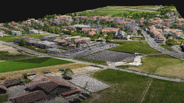
Processing capability, output formats, and workflow integration at a glance.
The defining constraint of professional photogrammetry has always been dataset size. A 500-image project processes comfortably on standard software. A 5,000-image project takes hours. A 50,000-image corridor mapping project the scale that a modern high-resolution sensor produces across a multi-day survey campaign is where conventional photogrammetry software either fails outright or requires the project to be split into artificially separated chunks that then require manual reassembly and introduce seam errors at every junction.
PIX4Dmatic processes these datasets as single projects. The processing architecture manages memory allocation and multi-core distribution around the reality of very large image collections, maintaining processing throughput at dataset sizes where other platforms degrade non-linearly. The result is a single continuous output across the full project extent one orthomosaic, one point cloud, one terrain model, without the seams and inconsistencies that chunked processing introduces.
For African mapping programmes at national and regional scale where a single campaign may generate more imagery than an entire year of smaller project work the ability to process the campaign as a coherent single project rather than dozens of separately processed and manually reconciled sections directly determines the deliverable quality and the programme's delivery timeline.
Professional survey deliverables require more than a visually acceptable output they require documented, verifiable accuracy that the client, the regulator, or the court can rely on. PIX4Dmatic's quality reporting produces the accuracy documentation that formal survey submission demands.
Ground Control Point Integration Manual and automatic GCP marking with residual analysis showing the fit between the photogrammetric solution and the surveyed control positions.
Checkpoint Verification Independent checkpoints excluded from the solution provide unbiased accuracy verification, producing the RMS error figures that survey accuracy statements are based on.
RTK and PPK Support Direct georeferencing from aircraft RTK position data, with PPK post-processing support where real-time correction was unavailable or interrupted during collection.
Quality Reporting Automated project quality reports documenting image calibration success, tie point density, georeferencing accuracy, and the processing parameters applied the audit documentation that formal deliverable submission requires.
Corridor mapping roads, railways, pipelines, powerlines, and river systems presents specific photogrammetric challenges that general-purpose processing handles poorly. The geometry is extremely elongated. The image overlap pattern is narrow. Cumulative positional drift along the corridor length degrades accuracy at the far end without adequate control.
PIX4Dmatic handles corridor geometry natively. Processing algorithms are optimised for the narrow, elongated project shape that corridor mapping produces, maintaining accuracy consistency across the full corridor length rather than degrading progressively with distance from the project origin.
For African infrastructure operations Uganda's crude export pipeline route, Kenya's SGR railway corridor, Ethiopia's expanding highway network, Nigeria's transmission line infrastructure corridor mapping represents a substantial and growing share of professional survey work, and PIX4Dmatic's corridor handling is the specific capability that makes these projects processable to survey accuracy.






Why Operators Buy PIX4Dmatic Through aerosmart
Every PIX4Dmatic licence supplied by aerosmart is genuine, fully featured, and connected to the official update programme. No restricted-feature grey market licences.
Remote licence activation for operators across every African market aerosmart serves.
Advice on integrating PIX4Dmatic alongside DJI Terra in a combined processing workflow using each platform for the project types it handles best.
Hardware specification advice for the processing workstation your dataset volumes require, and licence tier selection for your project throughput.
Dubai-based technical team for processing workflow troubleshooting and output configuration guidance.
Project setup, GCP marking, quality report interpretation, corridor project configuration, and output format selection training available remotely and in-person.
Contact aerosmart for licence pricing and multi-seat organisational quotes.
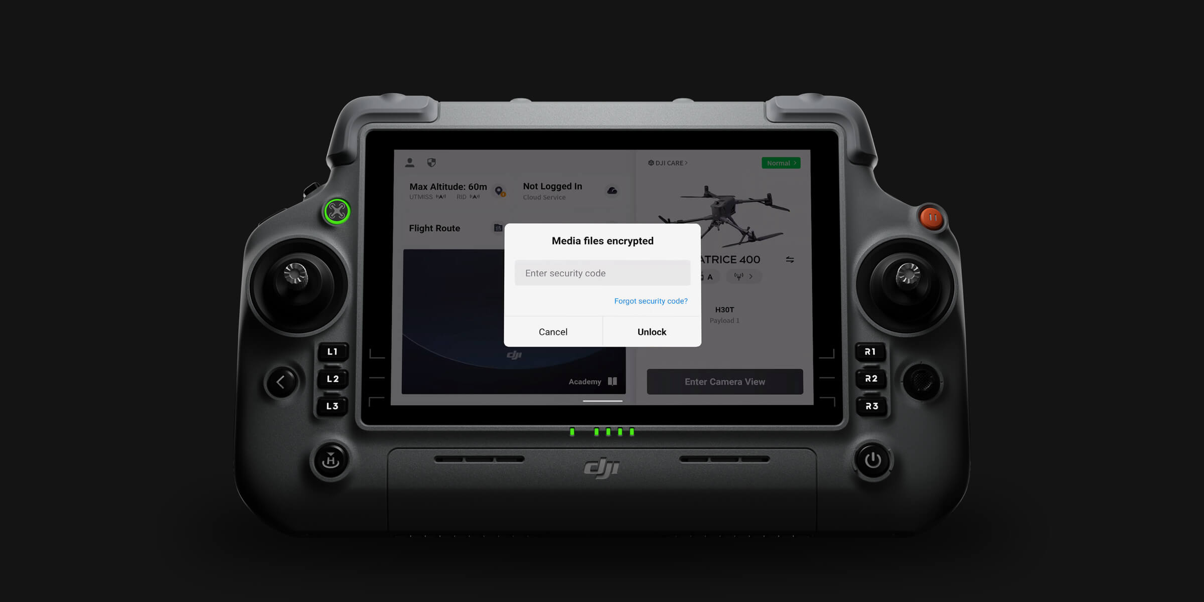
PIX4Dmatic processes entirely on the operator's local hardware. Survey imagery and processed outputs never leave the operator's controlled infrastructure unless explicitly exported. For government mapping agencies, land administration authorities, and clients with data sovereignty obligations across African markets, local processing eliminates the cloud data transfer exposure that hosted processing services introduce.
PIX4Dmatic licences are available from aerosmart with remote activation across 14+ African countries. Contact our team for pricing and configuration advice.
PIX4Dmatic is a large-scale photogrammetry processing platform for terrestrial and aerial mapping projects producing orthomosaics, point clouds, digital surface and terrain models, and 3D meshes from image datasets that exceed conventional processing software capacity.
PIX4Dmatic handles projects of tens of thousands of images as single continuous projects, the scale at which conventional photogrammetry software requires artificial project splitting that introduces seam errors.
DJI Terra is fully integrated with the DJI hardware ecosystem, processes LiDAR and multispectral alongside photogrammetry, operates completely offline, and suits the majority of professional survey workflows.
PIX4Dmatic is optimised for very large photogrammetric datasets, corridor project geometry, and deeper third-party GIS integration. Many African survey operations use both.
Yes. PIX4Dmatic supports direct georeferencing from aircraft RTK data and PPK post-processing where real-time correction was unavailable, alongside conventional ground control point workflows.
Yes. Processing runs entirely on local hardware without cloud connectivity, making it suitable for remote field processing and for organisations with data sovereignty requirements.
LAS, LAZ, and PLY point clouds; GeoTIFF and Google Tiles orthomosaics; GeoTIFF and XYZ terrain models; and OBJ, FBX, and SLPK mesh outputs covering the format requirements of major GIS, CAD, and BIM platforms.
Licence pricing varies by tier and seat count. Contact aerosmart at Sales@aerosmartglobal.com for an accurate quote.

Fill in your details below and our team will get back to you
with a personalized quote.