

Africa's mining sector is one of the continent's most significant economic contributors and one of the most demanding environments for accurate, frequent and safely acquired geospatial data. Mining operations across Zambia, Ghana, the Democratic Republic of the Congo, Zimbabwe, Mozambique, Tanzania and Guinea depend on reliable survey data for production measurement, resource management, operational planning, safety monitoring and regulatory reporting.
Traditional ground-survey methods face serious limitations in active mining environments. Operating stockpile areas, blasted benches, haul roads and active pit faces can expose survey personnel to moving machinery, unstable ground and restricted blast zones. Access controls may also prevent survey teams from entering the areas where measurements are most urgently required.
DJI enterprise drones enable mining teams to collect survey data from the air, reducing the need for personnel to enter hazardous operating areas. Drone-based workflows can support faster data capture, more frequent surveys and improved visibility across active mine sites.
Stockpile volume measurement is essential for production accounting, inventory control and contractual reporting. Ore concentrate, waste rock, coal and other mineral stockpiles represent measurable asset value that mine management teams, trading partners and auditors need to quantify accurately at regular intervals. Inaccurate volume estimates can create significant errors in production and inventory reporting.
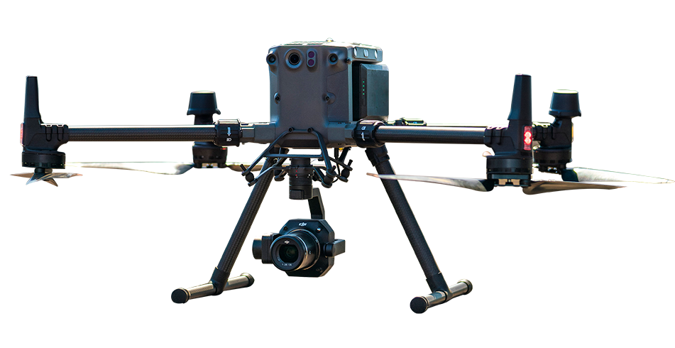
The DJI Matrice 350 RTK equipped with the Zenmuse P1 can survey a mine stockpile yard containing multiple stockpiles in a single planned mission. DJI Terra can process the captured imagery into point clouds and digital surface models. Individual stockpile volumes can then be calculated against an appropriate reference surface, providing both stockpile-level measurements and an overall yard-inventory record.
This workflow can support copper-concentrate stockpiles in Zambia, coal inventories in Mozambique, gold-ore stockpiles in Ghana and bauxite storage facilities in Guinea. It provides mining teams with repeatable and rapidly available data for production management, inventory reconciliation and contractual compliance.
Open-pit geometry includes benches, haul roads, pit walls and the current mine floor. This information supports mine planning, blast design, production reconciliation and slope-management workflows. The frequency of survey updates affects how closely actual mining activity can be compared with the approved mine plan.
The DJI Matrice 400 equipped with a compatible LiDAR payload can support large-area open-pit surveys and detailed point-cloud capture. The resulting datasets can assist with bench-dimension verification, haul-road assessment, pit-wall mapping and reconciliation between excavated geometry and mine design. Final accuracy and coverage depend on flight altitude, survey control, terrain, payload configuration and processing methods.
Tailings storage facilities contain mine-process waste and require structured monitoring because changes in embankments, water levels, drainage conditions and surrounding terrain can present serious environmental and safety risks. Mining regulations, engineering standards and ESG frameworks increasingly require documented and repeatable monitoring of these facilities.
A DJI Dock 3 workflow can support scheduled drone surveys of tailings-dam embankments and surrounding areas. Repeated surveys can generate dated and georeferenced digital surface models that help identify surface change, crest movement, settlement patterns, potential seepage areas and water-level variation. DJI FlightHub 2 can support mission management, data review and the creation of a consistent monitoring record.
Compare DJI enterprise drone platforms, payloads and software solutions for stockpile volumetrics, open-pit mapping and tailings-dam monitoring across mining operations in Africa.
| Application | Platform | Payload / Software | Output |
|---|---|---|---|
| Stockpile volumetrics |
DJI Matrice 350 RTK
|
Zenmuse P1 | Digital surface model, volume calculations and stockpile inventory records |
| Open-pit geometry |
DJI Matrice 400
|
Compatible LiDAR payload | High-density point cloud, pit-geometry mapping and detailed bench surveys |
| Tailings-dam monitoring |
DJI Dock 3 with DJI Matrice 4D
|
DJI FlightHub 2 | Scheduled digital surface models, settlement monitoring and site-change records |
DJI enterprise drones support stockpile volumetric measurement, open-pit geometry mapping, tailings-dam monitoring and haul-road condition assessment. Survey data can be collected from the air without requiring personnel to enter hazardous or active operating areas. Faster and more frequent data capture can help reduce measurement errors and improve mine-planning decisions.
When the DJI Matrice 350 RTK is used with the Zenmuse P1 and an appropriate survey workflow, stockpile volume accuracy of approximately ±1–2% may be achievable. Actual results depend on flight planning, RTK correction quality, ground control, stockpile geometry, image overlap, processing settings and site conditions.
Yes. DJI Dock 3 can support scheduled surveys of tailings-dam structures and surrounding areas. These surveys can produce dated and georeferenced digital surface models that help identify embankment settlement, crest movement, surface change and potential seepage-zone development between survey dates. The resulting record can support engineering inspections, regulatory reporting and ESG documentation.

Fill in your details below and our team will get back to you
with a personalised quote.