
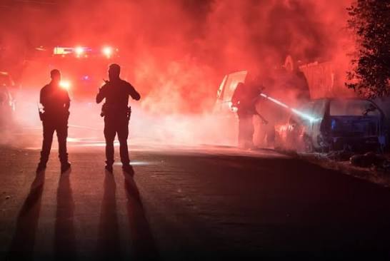
Emergency response is a race against information. The fire commander arriving at a burning structure does not know where the fire seat is, whether anyone is inside, or which section is closest to collapse. The rescue coordinator managing a search across bush terrain does not know where to concentrate the teams. The disaster response officer arriving after a flood does not know which communities are cut off or which roads can still carry traffic.
Every one of those answers exists. They exist a hundred metres above the incident, visible to a thermal camera, resolvable by a zoom lens, and deliverable to the incident commander within ninety seconds of a drone leaving the ground.
Across African markets, that capability matters disproportionately. Aerial support that European and North American agencies obtain from helicopter fleets is not available to most African emergency services at the frequency incidents demand. A drone in the response vehicle costs a fraction of a helicopter hour and arrives with the first responding unit rather than thirty minutes later.
Aerosmart supplies, configures, and supports the complete DJI Enterprise public safety ecosystem across 14+ African countries as an authorised DJI Enterprise dealer. This includes aircraft platforms, thermal payloads, autonomous stations, coordination software, and the operator training that turns equipment into an effective response capability.
| Specification | Detail |
|---|---|
| Rapid Response Platforms | Matrice 4T · Matrice 30T |
| Extended Operations | Matrice 400 · Matrice 350 RTK |
| Autonomous Response | DJI Dock 3 · DJI Dock 2 |
| Thermal Payloads | Zenmuse H30T · H20T · H20N |
| Illumination | Zenmuse S1 500 m LEP spotlight |
| Broadcast | Zenmuse V1 129 dB, 700 m range |
| Cargo Delivery | FlyCart 30 · FlyCart 100 |
| Deployment Time | 30 seconds with Matrice 4T |
| Flight Endurance | Up to 59 minutes |
| Environmental Rating | IP55 · -20°C to 50°C |
| Coordination Software | DJI FlightHub 2 |
| Night Capability | Thermal · Starlight · NIR illumination |
| Delivery Markets | 14+ African countries |
Ground teams operating without overhead intelligence assess the situation at the moment of contact, which is when assessment error carries the highest cost. A drone airborne before the team advances gives the commander an overview of the layout, hazards, and people before personnel are committed.
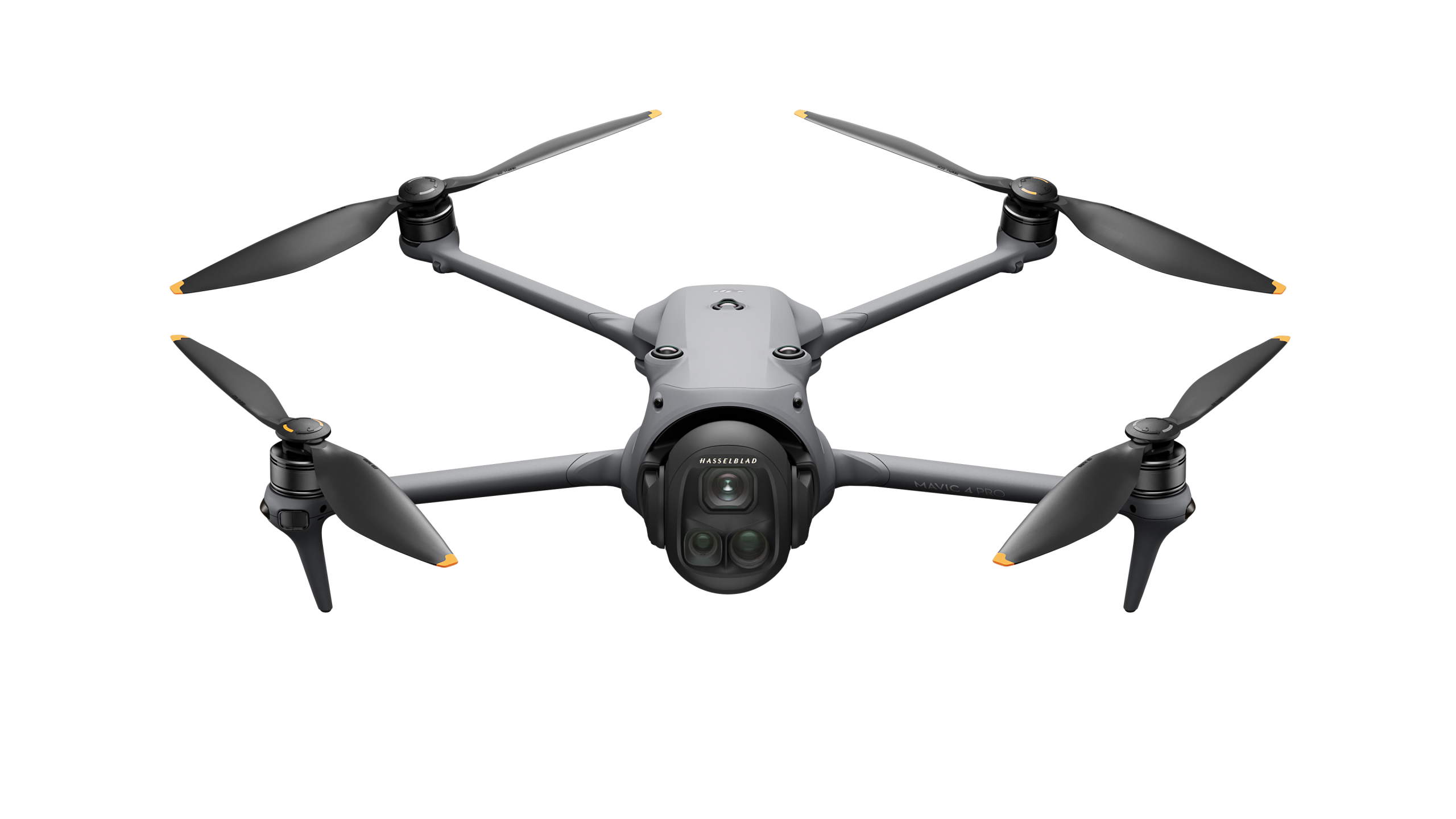
The Matrice 4T weighs approximately 1.2 kg, fits inside a response vehicle, and can reach airborne status in approximately 30 seconds. The responding officer can launch it from the scene perimeter and stream live thermal and visual intelligence to the command post before the ground unit deploys.
Thermal imaging through smoke helps identify the fire seat inside a structure, detect survivor body heat in spaces that rescue teams cannot yet enter, and assess radiant heat loading on adjacent buildings before secondary ignition occurs. This is particularly important in the high-density settlement areas of Nairobi, Lagos, Accra, Kampala, and Dar es Salaam.
Thermal perimeter mapping across large fire events helps identify the active front, direction of spread, and stable boundary sections. DJI Dock 3 autonomous stations positioned near conservation area boundaries can support early-stage fire detection during the dry season before an incident expands beyond ground suppression capability.
Thermal imaging can detect human body heat through vegetation, in darkness, and across terrain that ground teams can cover only at walking pace. GPS coordinates of confirmed detections can be transmitted directly to recovery teams. FlyCart 30 can also deliver emergency supplies to located survivors before ground personnel arrive.
Rapid post-event aerial assessment helps map flood extent, infrastructure damage, road passability, and the locations of isolated communities. This logistics intelligence can determine how quickly aid reaches the people who need it after cyclones, floods, and seismic events.
Cyclones and coastal flooding
Mozambique, Madagascar, Tanzania, and Kenya's coastline face
intensifying Indian Ocean cyclone seasons that can destroy road
networks and isolate communities during the exact hours when response
speed determines survival.
Seasonal riverine flooding
Nigeria's Niger-Benue confluence, Ethiopia's highland systems,
Uganda's Lake Victoria catchment, and Zambia's flood plains experience
recurring events that national disaster agencies must manage
simultaneously across wide geographical areas.
Dry-season fires
The savanna belt from Senegal to Ethiopia, East Africa's highland
grasslands, and the miombo woodlands across Central and Southern Africa
experience annual fire seasons where early detection determines whether
an incident remains contained.
Urban density and fire risk
Informal settlement areas across African cities combine high building
density, combustible construction, limited emergency-vehicle access,
and dense populations, creating fire events where aerial intelligence
can directly influence rescue prioritisation.
| Requirement | Platform | Payload |
|---|---|---|
| Rapid patrol response | Matrice 4T | Integrated thermal + visual + tele |
| All-weather extended incident | Matrice 30T | Integrated hybrid sensor |
| Major incident command | Matrice 400 | Zenmuse H30T |
| Night operations | Matrice 400 | Zenmuse H20N + S1 |
| Evacuation coordination | Matrice 400 | Zenmuse V1 |
| Autonomous early detection | DJI Dock 3 | Matrice 4TD |
| Emergency supply delivery | FlyCart 30 / FlyCart 100 | Cargo box / winch |
01 Authorised DJI Enterprise Dealer
Every platform carries an original DJI warranty, current firmware
certification, and documentation valid for aviation authority
registration across African markets.
02 Delivery Across 14+ Countries
Direct shipping is provided with full export documentation and import
duty guidance for every destination.
03 Regulatory Guidance Included
Every solution includes a country-specific written RPAS brief covering
operator certification, equipment registration, and emergency-response
airspace considerations.
04 Response-Specific Configuration
Platform and payload selection is matched to your response profile,
operating terrain, deployment model, and mission requirements.
05 Post-Sale Support and Servicing
Dubai-based repair, maintenance, and remote diagnostic support are
available to clients across supported markets.
06 Operator Training
Training covers thermal interpretation, rapid deployment procedures,
and DJI FlightHub 2 multi-team coordination through Aerosmart Academy.
07 Complete Programme Configuration
Aircraft platforms, payloads, software, operator training, and support
are supplied as one complete working response capability.
DJI Enterprise drones provide real-time thermal and visual intelligence during incidents. They can help locate fire seats through smoke, detect survivors by body heat, map flood and fire extent, deliver emergency supplies to isolated communities, and broadcast evacuation guidance from the air.
The DJI Matrice 4T can reach airborne status in approximately 30 seconds. With a carry weight of approximately 1.2 kg, it is a fast-deploying, multi-sensor enterprise platform suitable for carriage in emergency-response vehicles.
Yes. Thermal cameras can detect human body heat in complete darkness. The Zenmuse H20N also provides starlight-grade low-light visible imaging and dual thermal zoom for night-time search operations.
Yes. The DJI FlyCart 30 can carry 30 kg across 16 km, while the FlyCart 100 can carry payloads of up to 100 kg, depending on its operating configuration. Both can deliver supplies to GPS coordinates identified by search aircraft and support winch delivery where landing is impractical.
IP55-rated platforms, including the Matrice 400, Matrice 350 RTK, and Matrice 30T, are designed for operation in challenging conditions involving rain, dust, and humidity.
Yes. DJI FlightHub 2 can share live aerial video and aircraft positions with multiple responding agencies through secure livestream links and coordinated operational views.
Yes. Aerosmart Academy delivers public safety operations training on-site across supported African markets and through its Nairobi Academy. Training can be delivered in English, French, and Arabic.
Aerosmart supplies African markets including Kenya, Nigeria, Ethiopia, Ghana, Tanzania, Uganda, Rwanda, Zambia, Mozambique, Malawi, Zimbabwe, Namibia, Chad, Mali, Togo, The Gambia, Sierra Leone, Seychelles, the Republic of the Congo, the Democratic Republic of the Congo, and Côte d'Ivoire.

Fill in your details below and our team will get back to you with a personalised quote.