
Long-Endurance Drone Platform With Power-Line-Level Obstacle Sensing
Engineered for Excellence, Designed for Versatility
DJI Zenmuse P1 The New Benchmark for Aerial Surveying. Available from aerosmart, Authorised DJI Dealer
Authorised DJI Dealer Genuine Product, Full Warranty
45MP Full-Frame Sensor · 3 Cm Horizontal Accuracy Without GCPs
Compatible With DJI Matrice 400, Matrice 350 RTK, Matrice 300 RTK
Delivery Across 14+ Countries With Export Documentation
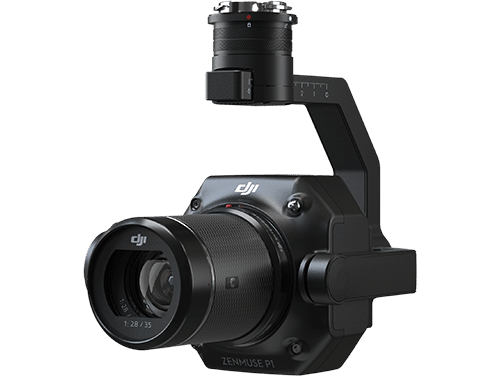
The DJI Zenmuse P1 integrates a full-frame sensor with interchangeable fixed-focus lenses on a 3-axis stabilised gimbal, designed for photogrammetry flight missions and built to take efficiency and accuracy to a whole new level. It is the new benchmark for aerial surveying, earning that description through the combination of three capabilities that no comparable photogrammetry payload delivers simultaneously at this price point: extraordinary efficiency, remarkable accuracy, and robust versatility.
Efficiency comes from a 45MP full-frame, low-noise, high-sensitivity sensor that captures a photo every 0.7 seconds during flight and covers up to 3 km² in a single mission and 7.5 km² across a full working day. Accuracy comes from a global mechanical shutter paired with the TimeSync 2.0 system, which synchronises the camera, flight controller, RTK module, and gimbal at the microsecond level, delivering centimetre-level data without requiring ground control points. Versatility comes from an interchangeable lens system supporting 24mm, 35mm, and 50mm DJI DL mount lenses, alongside Smart Oblique Capture, which automates the multi-angle photography required for complete 3D model reconstruction in a single automated flight.
Aerosmart supplies and supports the DJI Zenmuse P1 as an authorised DJI dealer. Our team ensures you receive the right lens configuration, the right platform pairing, and comprehensive technical support from day one.
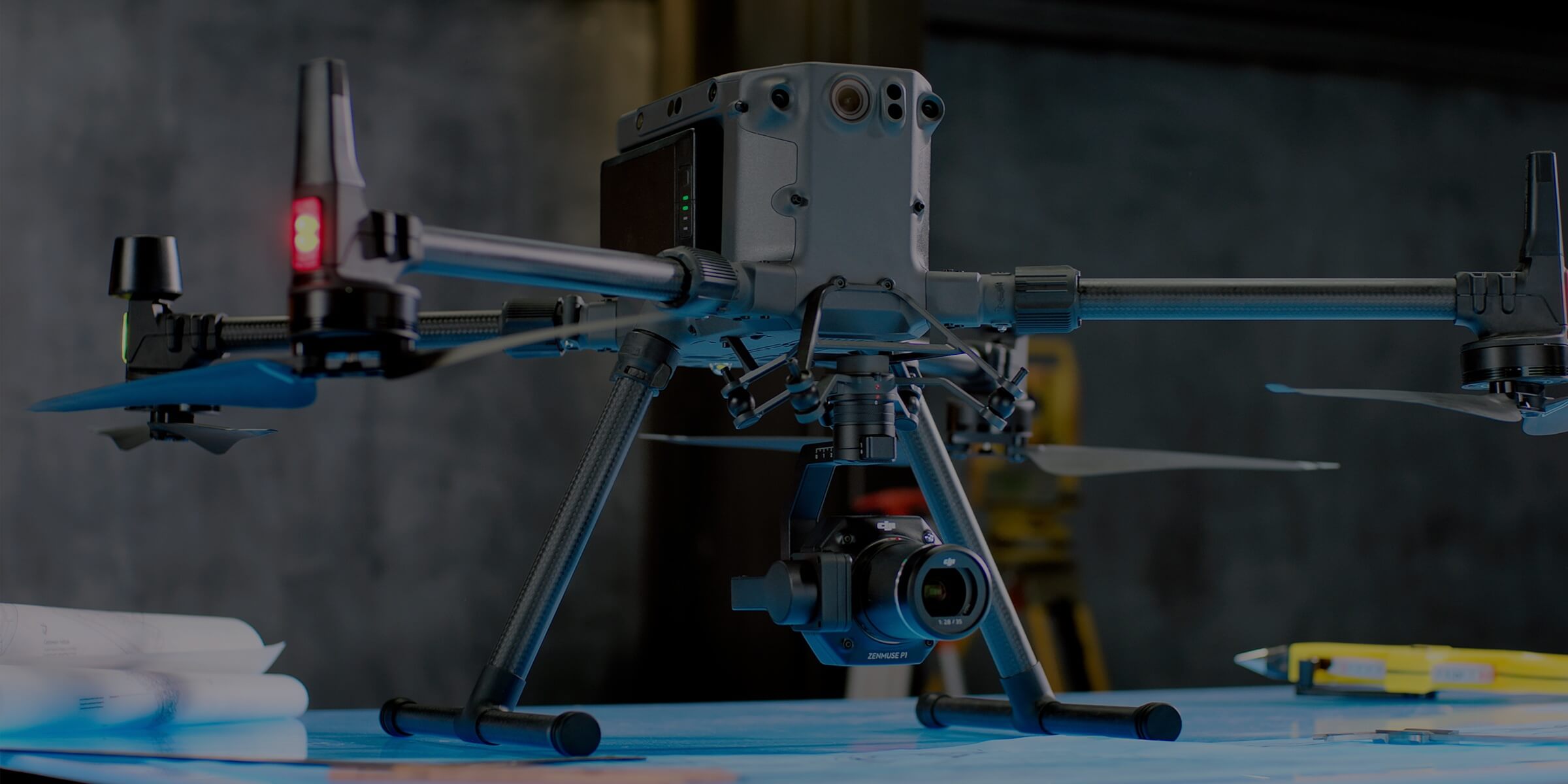
Full-frame imaging, centimetre-level accuracy, interchangeable lenses, and professional photogrammetry performance at a glance.
Photogrammetric survey efficiency is determined by three variables: sensor resolution per image, the rate at which images can be captured without motion blur, and the ground area covered in a single flight battery cycle. The DJI Zenmuse P1 pushes all three beyond what previous-generation survey payloads achieved and, in doing so, changes the economics of aerial photogrammetry for professional survey operations.
45MP Full-Frame Sensor — 4.4 μm Pixel Size
A 45-megapixel full-frame sensor produces the combination of high resolution and a large 4.4 μm pixel size that delivers both the ground sampling distance required for survey accuracy and the low-noise performance needed for high-sensitivity imaging in variable lighting conditions. Full-frame sensors gather more light per pixel than smaller APS-C and 4/3 sensors, producing lower noise at any given ISO setting and enabling sharp, usable imagery across the wider range of lighting conditions encountered during a full working day of survey operations—from the bright, high-contrast light of midday to the lower-angle, lower-intensity light of early morning and late afternoon sessions that extend daily coverage.
The 4.4 μm pixel size directly influences the ground sampling distance achievable at a given altitude. Larger pixels help the P1 maintain the image resolution required for survey accuracy while operating at practical flight altitudes. This translates into a wider survey swath per pass, fewer flight passes per area, and faster total area coverage during each battery cycle.
Photo Every 0.7 Seconds
The P1's global mechanical shutter captures an image every 0.7 seconds throughout the survey flight. This rapid capture rate supports the aircraft's forward speed and the image-overlap requirements needed for photogrammetric reconstruction while reducing the risk of motion blur at operational flight speeds. A 0.7-second capture interval at standard survey speeds helps maintain the 70–80% forward overlap commonly required for complete, gap-free photogrammetric coverage.
3 km² per Flight — 7.5 km² per Working Day
Covering up to 3 km² in a single flight mission and up to 7.5 km² across a full working day with battery rotations allows the P1 to complete medium and large survey projects within practical field schedules. Urban-planning blocks, mine-site extents, construction footprints, and agricultural estate boundaries that previously required multiple field days can potentially be surveyed within a single operational day using one aircraft and one operator, depending on flight conditions, mission settings, overlap requirements, and local regulations.
Three centimetres of horizontal accuracy and five centimetres of vertical accuracy—without placing a single ground control point across the survey area—is the specification combination that defines the DJI Zenmuse P1 as a survey-grade photogrammetry payload rather than simply a high-resolution mapping camera. This level of accuracy supports demanding applications such as cadastral surveying, construction earthwork calculations, and engineering-grade topographic datasets.
Global Mechanical Shutter — 1/2000 s
The P1's global mechanical shutter exposes the entire image simultaneously at speeds of up to 1/2000 of a second, helping eliminate the rolling-shutter distortion that can occur when a camera sensor is moving forward during exposure. Rolling-shutter distortion can deform straight lines and introduce positional errors into image points, reducing the geometric reliability of photogrammetric outputs used for precision surveying.
By capturing every part of the image at the same moment, the 1/2000 s global mechanical shutter produces geometrically consistent imagery at operational survey speeds. This reduces the need for rolling-shutter correction during post-processing and supports more accurate orthophotos, digital surface models, and digital terrain models.
TimeSync 2.0 — Microsecond-Level Synchronisation
TimeSync 2.0 synchronises the camera, flight controller, RTK module, and gimbal at the microsecond level. It aligns the aircraft's precise position and attitude data with the exact moment each image is captured, helping ensure that the geolocation and orientation information stored in the image metadata accurately reflects the aircraft's position at the time of exposure.
This microsecond-level synchronisation helps translate the aircraft's RTK positioning data into accurately georeferenced survey imagery. By maintaining a precise connection between satellite positioning, aircraft attitude, and image capture timing, TimeSync 2.0 reduces the positional lag errors that can occur with less precise synchronisation systems.
RTK Accuracy Without GCPs
Achieving approximately 3 cm horizontal accuracy and 5 cm vertical accuracy without ground control points can significantly reduce the most time-consuming parts of a professional photogrammetry survey. Projects that previously required extensive GCP placement and measurement may be flown more quickly after the aircraft establishes a stable RTK connection, depending on the mission environment and required deliverables.
For survey teams working across remote terrain, large estates, construction zones, or active mine sites, reducing reliance on ground control points can simplify field operations and limit the need for personnel to enter difficult or hazardous areas. This makes the P1 especially valuable for large-scale projects where conventional GCP deployment may be operationally complex, time-consuming, or unsafe.
Mission results are automatically organised using the Mission Name and Mission Time, ensuring that photographs, GNSS data, and TimeStamps.MRK files remain grouped together from the moment they are captured.
Each image also stores essential metadata including camera intrinsic parameters, camera extrinsic parameters, and RTK positioning status, allowing photogrammetry software to begin accurate georeferencing with minimal manual preparation.
Learn More ↗Before leaving the survey site, operators can review RTK status, positioning accuracy, image count, and GPS information directly inside DJI Pilot 2. Instant image playback allows quick confirmation that coverage and positioning meet project requirements.
This verification process helps identify coverage gaps, loss of RTK lock, or positioning issues while the aircraft is still on-site, allowing corrective flights to be completed before the survey team departs.
Learn More ↗DJI Terra enables field teams to generate real-time maps as imagery is captured, providing immediate access to geographic information without waiting for full office-based processing.
As the aircraft flies, DJI Terra progressively builds a detailed map that supports on-site decision-making, situational awareness, and rapid project assessment, helping survey teams respond faster and validate mission progress while still in the field.
Learn More ↗DJI Terra processes incoming P1 imagery during the flight and builds a real-time geographic overview of the surveyed area, enabling field teams to confirm coverage completeness, identify areas requiring additional passes, and make operational decisions based on the developing map before the aircraft lands.
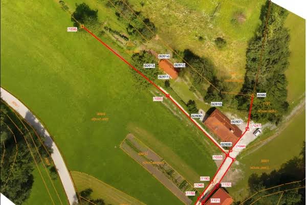
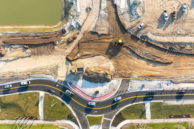

As an authorised DJI dealer, aerosmart provides genuine products, lens configuration consultation, platform pairing guidance, international delivery, technical support, training, and competitive pricing.
Every DJI Zenmuse P1 carries an original DJI warranty, current firmware certification, and regulatory-compliant documentation. No parallel imports. No counterfeit risk.
Our team advises on the right lens configuration— 24mm, 35mm, or 50mm— for your specific survey application, project scale, coverage requirement, and accuracy target before purchase.
We advise on the optimal aircraft platform— DJI Matrice 400, Matrice 350 RTK, or Matrice 300 RTK—for your survey programme requirements, operating environment, and preferred workflow.
Direct international shipping with complete export documentation, customs support, and import-duty guidance for every destination market.
Dubai-based technical support for remote diagnostics, firmware updates, lens maintenance guidance, and hardware servicing throughout the full operational life of the system.
Training is available for P1 operation, DJI Terra real-time and post-processing workflows, Smart Oblique Capture configuration, RTK setup, and post-flight data verification. Sessions are available remotely and in person.
Contact aerosmart for Zenmuse P1 pricing by lens configuration, complete Matrice 350 RTK + P1 survey system quotations, and DJI Terra software licensing.
Every DJI Zenmuse P1 purchased through aerosmart comes with access to DJI Care Enterprise Plus, covering the payload from its activation date.
All DJI Care Enterprise Plus activations and warranty claims are handled directly by aerosmart, with no overseas routing and no third-party intermediaries.
Unlimited free repairs within the available coverage limit for the full duration of the plan.
Share the available coverage limit across your complete enterprise payload fleet.
Mail-in repairs include two-way shipping, with no hidden repair or logistics costs.
Repairs are completed by DJI-certified engineers using original manufacturer-approved components.
An additional one-year warranty option is available for major payload components.
The DJI Zenmuse P1 is available from aerosmart, an authorised DJI dealer with delivery across 14+ countries. Contact our team for pricing, lens configuration advice, platform selection, and availability.
The DJI Zenmuse P1 achieves approximately 3 cm horizontal accuracy and 5 cm vertical accuracy without ground control points when used with a compatible RTK-enabled platform, such as the DJI Matrice 350 RTK or DJI Matrice 300 RTK. This delivers survey-grade positional accuracy while reducing the field time normally required for GCP placement and measurement.
The DJI Zenmuse P1 can cover up to 3 km² in a single flight mission and up to 7.5 km² across a full working day with battery rotations on a compatible Matrice RTK platform. Actual coverage depends on flight altitude, required image overlap, terrain, weather, and local operating conditions.
The Zenmuse P1 supports three interchangeable fixed-focus lenses on the DJI DL mount: a 24mm lens for maximum field of view and coverage efficiency, a 35mm lens for general surveying and cadastral mapping, and a 50mm lens for finer ground sampling distance and higher-detail imaging at a given flight altitude.
Smart Oblique Capture automatically rotates the P1's 3-axis gimbal to capture the five standard viewing angles required for complete photogrammetric 3D reconstruction: one nadir view and four oblique views. It can reduce post-processing time by 20% to 50% by limiting unnecessary image capture around the edges of the mission area.
Yes. The P1 uses a global mechanical shutter with a shutter speed of up to 1/2000 s. It exposes the image simultaneously, helping eliminate rolling-shutter distortion during forward flight and supporting geometrically reliable imagery for professional photogrammetry.
The DJI Zenmuse P1 is compatible with supported enterprise platforms including the DJI Matrice 400, DJI Matrice 350 RTK, and DJI Matrice 300 RTK. aerosmart can recommend the most suitable platform based on your required flight endurance, survey coverage, operating environment, and existing equipment.
DJI Zenmuse P1 pricing varies according to the selected lens, aircraft platform, DJI Terra software requirements, and destination country. Contact aerosmart at africa@aerosmart.ae for an accurate quotation for the payload or a complete photogrammetry survey system.

Fill in your details below and our team will get back to you
with a personalized quote.