
Long-Endurance Drone Platform With Power-Line-Level Obstacle Sensing
Engineered for Excellence, Designed for Versatility
DJI Zenmuse L2 Powerful Range, Elevated Precision. Available from aerosmart, Authorised DJI Dealer
Authorised DJI Dealer Genuine Product, Full Warranty
4 Cm Vertical Accuracy · 2.5 Km² Per Flight · 5 Returns
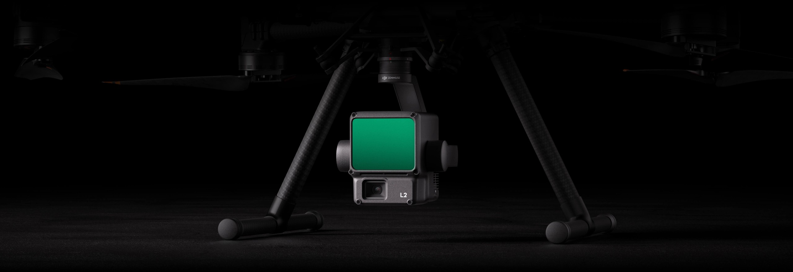
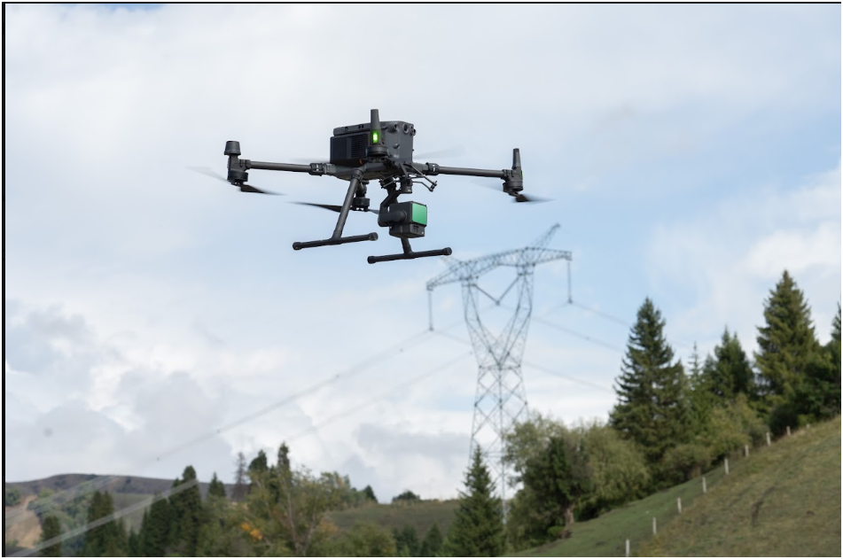
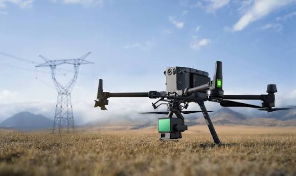
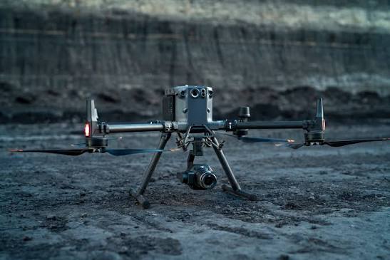
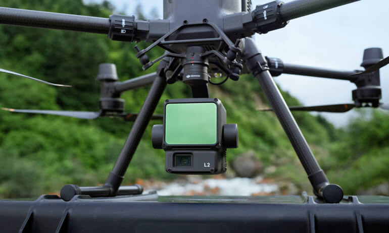
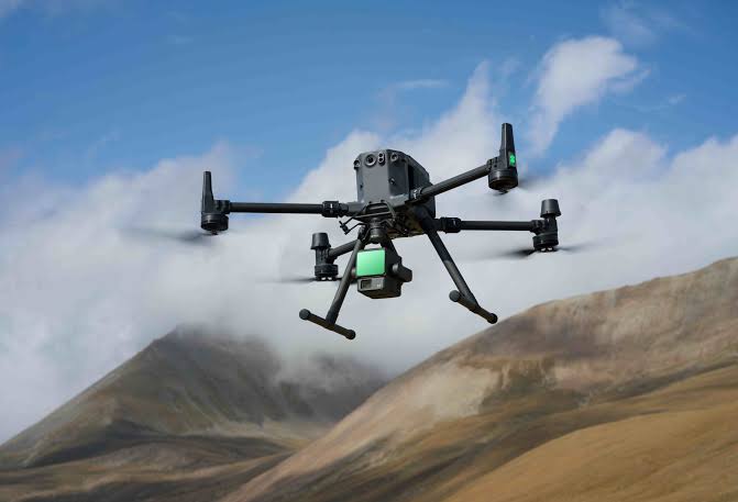
Compatible With DJI Matrice 350 RTK And Matrice 300 RTK
Delivery Across 14+ Countries With Export Documentation
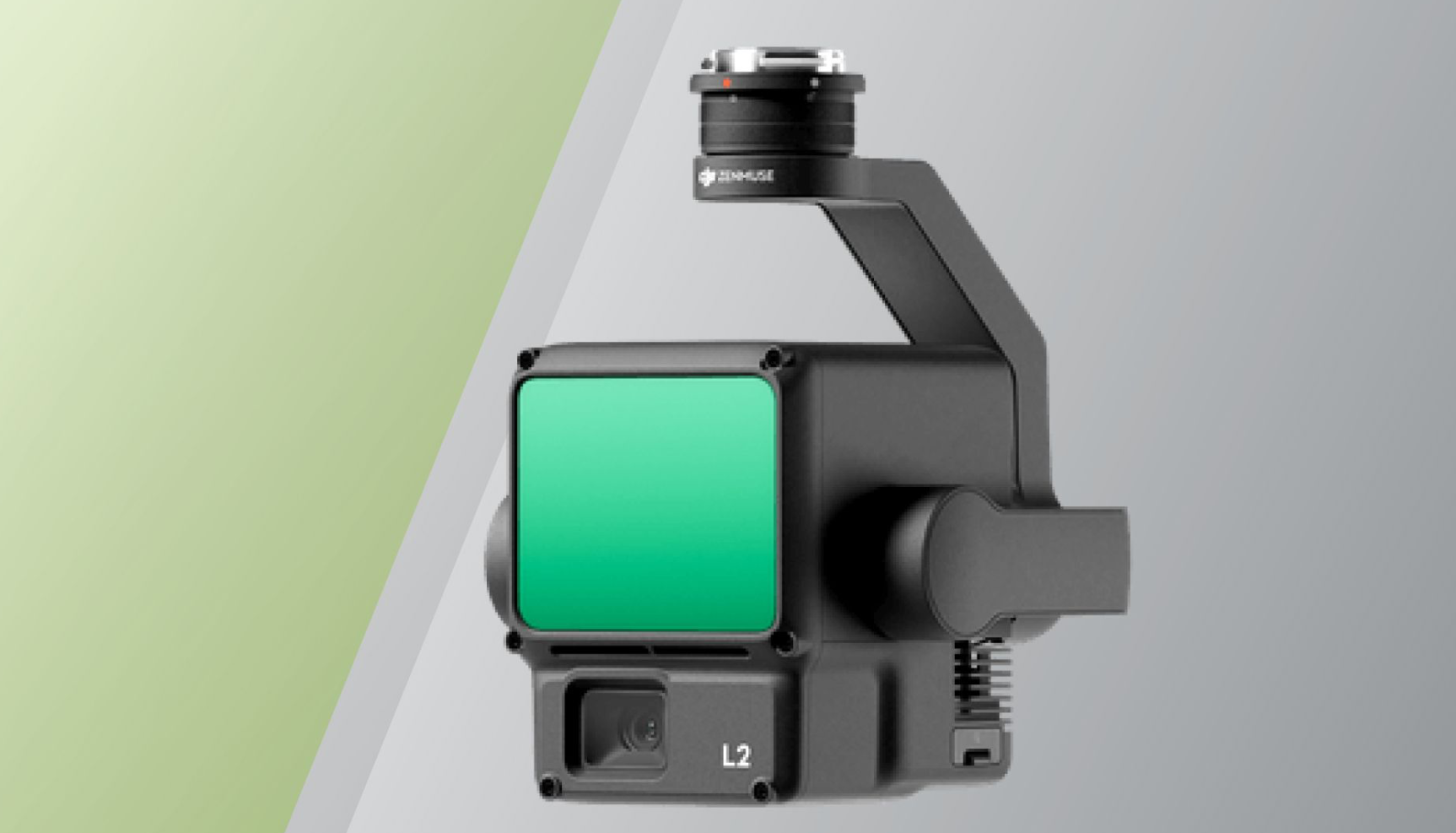
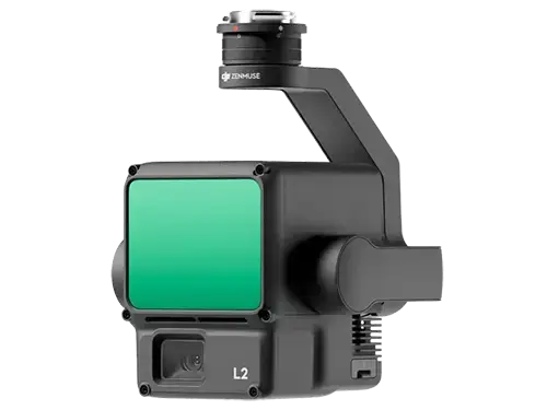
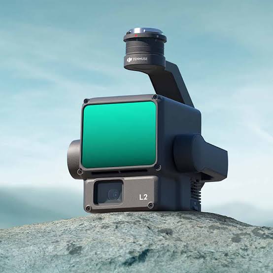
The DJI Zenmuse L2 integrates a frame LiDAR sensor, a self-developed high-accuracy IMU system, and a 4/3 CMOS RGB mapping camera into a single payload, providing DJI flight platforms with more precise, efficient, and reliable geospatial data acquisition than any previous DJI LiDAR system.
When used with DJI Terra, the L2 delivers a complete turnkey solution for 3D data collection and high-accuracy post-processing, from flight planning to the finished deliverable through a single integrated hardware and software workflow. Four-centimetre vertical accuracy, 2.5 km² coverage in a single flight, 5-return point cloud capability for dense environment penetration, and real-time Point Cloud LiveView define a LiDAR payload that raises the performance standard across every application that aerial LiDAR serves.
Point Cloud LiveView gives the operator real-time visualisation of the point cloud as the aircraft collects it, enabling immediate quality assessment, coverage confirmation, and mission adjustment decisions during the flight rather than after landing, when data gaps would require a repeat flight. One-click post-processing through DJI Terra delivers the final point cloud, DTM, and DSM outputs from the L2's combined LiDAR and RGB data with the minimum operator processing workload of any comparable LiDAR system.
Aerosmart supplies and supports the DJI Zenmuse L2 as an authorised DJI dealer. Our team ensures you receive the right system configuration, the optimal processing workflow, and comprehensive technical support from day one.
Performance, accuracy, mapping, and software compatibility at a glance.
Vertical accuracy of 4 cm and horizontal accuracy of 5 cm position the DJI Zenmuse L2 at the performance level that survey-grade geospatial applications require. This level of precision meets the accuracy standards demanded by cadastral boundary surveys, mine volumetric calculations, and infrastructure design topographic datasets, ensuring outputs that are legally defensible, commercially reliable, and technically suitable for engineering workflows.
What 4 cm Vertical Accuracy Means in Practice
Four centimetres of vertical accuracy at operational survey altitudes enables the creation of highly precise digital terrain models (DTMs) that accurately represent terrain profiles for drainage analysis, earthwork volume estimation, and foundation design. This level of precision significantly reduces positional uncertainty that could otherwise affect engineering and construction decisions.
For mining operations, where stockpile volumetric measurements determine contractual ore delivery quantities, the Zenmuse L2's 4 cm vertical accuracy provides measurements that withstand commercial verification. For cadastral surveys, where property boundaries carry legal significance, the 5 cm horizontal accuracy delivers the spatial precision required for national land administration standards and formal land registration.
Self-Developed High-Accuracy IMU
The exceptional accuracy of the Zenmuse L2 begins with its self-developed high-accuracy IMU (Inertial Measurement Unit). The IMU continuously tracks the sensor's position, orientation, and motion between GNSS position fixes and throughout rapid survey flight manoeuvres. This precision enables the system to transform raw LiDAR range measurements into accurately georeferenced point clouds, making the 4 cm vertical accuracy specification achievable in real-world survey missions.
The IMU is one of the most critical components influencing overall LiDAR system accuracy. While LiDAR sensors measure distance with high precision, an IMU introducing 10–15 cm of positional uncertainty would transfer that same level of error into the final point cloud. The Zenmuse L2's self-developed high-accuracy IMU keeps positioning error within the system's 4 cm vertical accuracy specification, delivering survey-grade point cloud data across a wide range of flight manoeuvres and environmental conditions.
A single flight covering 2.5 km² of survey area is the efficiency figure that determines the number of battery cycles, the number of operational days, and the total operational cost required to complete a survey project of a given size. At 2.5 km² per flight on the Matrice 350 RTK's 55-minute endurance, a full working day of Zenmuse L2 flights covers the majority of medium-scale survey projects, including urban planning areas, mine site extents, construction project footprints, and agricultural estate boundaries, within a single field day.
Low Beam Mode – 15° FOV, 150 Metres
Low Beam produces a 15° field of view with an illumination range of 150 metres, specifically matched to cameras operating at 5× zoom or higher. The illuminated area remains aligned with the camera's field of view instead of flooding unnecessary surroundings, making it ideal for close-range inspections, infrastructure maintenance, urban public safety operations, and search tasks where moderate-range illumination provides maximum efficiency.
For survey businesses managing project portfolios where field mobilisation cost per day is the dominant operational cost driver, 2.5 km² per flight directly determines project profitability. Fewer field days per project, fewer battery cycles per area, and less mobilisation overhead per square kilometre translate into the cost structure that makes drone LiDAR survey commercially competitive with terrestrial survey methods.
The 2.5 km² coverage figure applies at the operational altitudes and flight speeds that produce the point density and accuracy specification the Zenmuse L2 achieves. It is not a theoretical maximum at degraded performance settings. The complete accuracy, density, and RGB colourisation specifications of the L2 system are maintained across the 2.5 km² coverage area within a single flight battery cycle.
The DJI Zenmuse L2 delivers smaller laser spots that generate denser point clouds and significantly improve vegetation penetration. More laser pulses reach the ground surface through gaps in trees and foliage, producing accurate bare-earth Digital Terrain Models (DTMs) that conventional photogrammetry cannot achieve without vegetation removal.
Learn More ↗With up to five returns per laser pulse, the Zenmuse L2 captures multiple layers including the canopy, branches, understorey vegetation, ground cover, and bare earth. This provides the detailed vertical structure required for forest mapping, canopy height modelling, biomass estimation, and vegetation analysis.
Learn More ↗The 5-return capability accurately captures complex mine faces, stockpiles, and irregular terrain while separating vegetation from ground and infrastructure during corridor surveys. The result is clean terrain models and high-accuracy point clouds without the vegetation clearing often required for photogrammetry-based workflows.
Learn More ↗The DJI Zenmuse L2 detection range, with 250 m at 10% reflectivity and 450 m at 50% reflectivity, defines the operational altitude envelope where the system produces reliable, accurate point cloud data across real survey environments.
Learn More ↗10% reflectivity represents demanding low-reflectance surfaces such as dark soil, asphalt, dark rock, and low-reflectance vegetation. The Zenmuse L2 reliably detects these weak-return surfaces up to 250 metres, well above the 100–150 m operational altitudes used for most LiDAR survey missions.
Learn More ↗At 50% reflectivity, which represents common survey surfaces such as vegetation, concrete, and light-coloured soil, the L2 detection range extends to 450 metres. This provides strong altitude headroom for large-area mapping, reconnaissance flights, and consistent gap-free point cloud coverage.
Learn More ↗Point Cloud LiveView gives operators real-time visualisation of the developing point cloud as the aircraft collects LiDAR data during the active mission. This changes field QA from post-flight data assessment to in-flight quality monitoring.
Learn More ↗With Point Cloud LiveView, the operator can confirm complete coverage, check whether point density meets project requirements, and identify systematic data gaps during the flight instead of discovering issues later during office processing.
Learn More ↗When a coverage gap appears during the mission, the operator can adjust the flight in real time and add coverage passes before returning to base. For remote survey projects, tight timelines, and limited weather windows, LiveView helps prevent repeat field days, project delays, and additional mobilisation costs.
Learn More ↗The DJI Zenmuse L2 delivers a complete turnkey solution through deep integration between the hardware system and DJI Terra's processing workflow. Data collected during flight is processed in DJI Terra to produce final survey deliverables without requiring specialist LiDAR processing expertise or third-party software for routine survey applications.
DJI Terra's one-click processing workflow automatically applies IMU, GNSS, and LiDAR data fusion, corrects IMU drift, smooths the trajectory, fuses RGB camera data for colourisation, and generates the final classified point cloud and terrain model outputs in a single streamlined processing step.
The L2's integrated 4/3 CMOS RGB camera captures imagery simultaneously with the LiDAR scan, allowing DJI Terra to apply true-colour RGB values to every point in the point cloud. These colourised point clouds are easier for site engineers, project managers, and clients to interpret than monochrome intensity-only LiDAR outputs.
DJI Terra processes Zenmuse L2 data fully offline, with no cloud connectivity required for post-processing. This enables survey teams working in remote field environments to complete the full pipeline from flight to final deliverable in the field, helping make results available on the same day as the flight.
Continuous in-flight visualisation of the developing point cloud enables real-time quality monitoring, coverage monitoring, density assessment, and mission adjustment capability throughout the active flight.
As an authorised DJI dealer, aerosmart provides genuine products, system configuration consultation, delivery support, training, servicing, and competitive enterprise pricing.
Every Zenmuse L2 carries original DJI warranty, current firmware certification, and regulatory-compliant documentation. No parallel imports. No counterfeit risk.
Our team advises on platform pairing, DJI Terra licensing, D-RTK ground station requirements, and processing workflow setup before purchase.
Direct shipping with full export documentation and import duty guidance for every destination market.
Dubai-based technical team for remote diagnostics, IMU calibration guidance, DJI Terra workflow support, and hardware maintenance throughout the operational life of the system.
L2 system operation, DJI Terra LiDAR processing workflow, point cloud classification, colourisation, and deliverable export training are available remotely and in person.
Contact aerosmart for L2 pricing, complete system quotes including Matrice 350 RTK and DJI Terra, and multi-payload configuration options.
Every DJI Zenmuse L2 purchased through aerosmart comes with access to DJI Care Enterprise Plus covering the payload from activation date.
All DJI Care Enterprise Plus activations and warranty claims are handled directly by Aerosmart with no overseas routing and no third-party intermediaries.
Unlimited free repairs within the coverage limit for the full plan duration.
Shared coverage limit across your entire payload fleet.
Mail-in repairs with two-way shipping and no hidden logistics costs.
DJI-certified engineers using original manufacturer components.
Additional 1-year warranty option available on major components.
The DJI Zenmuse L2 is available from aerosmart, an authorised DJI dealer with delivery across 14+ countries. Contact our team for pricing, system configuration advice, and availability.
The DJI Zenmuse L2 achieves 4 cm vertical accuracy and 5 cm horizontal accuracy, providing survey-grade LiDAR performance suitable for cadastral surveys, mine volumetric measurement, construction earthwork calculations, and engineering design topographic datasets.
The DJI Zenmuse L2 covers 2.5 km² in a single flight at standard survey altitudes, enabling medium to large survey projects to be completed within a single operational field day when deployed on the DJI Matrice 350 RTK.
Point Cloud LiveView provides real-time visualisation of the developing point cloud during the survey flight, enabling operators to monitor coverage quality, identify data gaps, and adjust the mission in real time before returning to base, reducing the need for repeat flights.
Yes. The Zenmuse L2's smaller laser spots and 5-return LiDAR capability allow it to capture ground returns through vegetation canopy, producing accurate bare-earth digital terrain models in areas where photogrammetry cannot reach the ground surface.
The DJI Zenmuse L2 is compatible with the DJI Matrice 350 RTK and DJI Matrice 300 RTK. The Matrice 350 RTK is the recommended platform for new deployments thanks to its extended flight endurance and RTK positioning capability.
DJI Terra is the primary processing software for Zenmuse L2 data. It provides one-click post-processing to generate colourised point clouds, Digital Terrain Models (DTM), and Digital Surface Models (DSM) through an automated offline workflow.
The Zenmuse L3 offers higher point density, longer detection range, and dual 100MP RGB cameras compared with the Zenmuse L2's 4/3 CMOS RGB camera. The L2 is the ideal choice for most professional survey and mapping applications, while the L3 is designed for maximum performance and long-range, high-density LiDAR missions.
DJI Zenmuse L2 pricing varies depending on the system configuration and destination country. Contact aerosmart for a quotation covering the payload, compatible aircraft platform, DJI Terra software, and complete LiDAR system requirements.

Fill in your details below and our team will get back to you
with a personalized quote.