

Rwanda is one of the most drone-progressive countries in the world, not merely in Africa. Through early collaboration with private operators, it became one of the first nations to establish beyond-visual-line-of-sight (BVLOS) regulations, and its medical-delivery network now reaches the large majority of the country's hospitals. That posture—regulate to enable, not merely to restrict—makes Rwanda a natural environment for professional drone adoption.
The Rwanda Civil Aviation Authority (RCAA) administers a clear framework of registration, activity permits, operator certificates and pilot certification. For businesses and institutions, the country's compact geography, hilly terrain and strong public-sector coordination create dense, repeatable use cases in agriculture, health logistics, survey and conservation.
What separates a productive fleet from an idle one is the support around it: correct platform selection, clean registration and permit paperwork, certified pilots, and a reliable service pathway. Aerosmart Africa is built around that full lifecycle rather than a single sale, which is why Rwandan cooperatives, survey firms, health networks and agencies treat us as a long-term partner.
Aerosmart Africa supplies the complete DJI range into Rwanda as an authorised DJI Enterprise and DJI Agriculture dealer, with delivery to Kigali, Musanze, Rubavu and nationwide, RCAA regulatory guidance, and on-site training across the country.
Health and Cargo Logistics: Rwanda pioneered drone delivery of medical supplies, and the model continues to expand. Cargo platforms such as the DJI FlyCart 30 (up to 30 kg) and FlyCart 100 (up to 100 kg) extend that capability into heavier payload categories, supporting health networks, laboratories and supply chains across the country's hilly terrain where road access is slow.
Agriculture: Rwanda's terraced hillsides make ground application difficult and labour-intensive. Agriculture drones spray and spread on slopes and terraces with terrain-following precision, mapping crop health across coffee, tea, maize and horticulture, and delivering coverage that manual methods handle inconsistently.
Survey, Mapping and Land Administration: RTK mapping drones produce orthomosaics, elevation models and cadastral-grade parcel documentation across dense, fragmented terrain—exactly the geometry where aerial survey delivers throughput that terrestrial methods cannot match, supporting Rwanda's land-administration and urban-planning programmes.
Conservation and Tourism: Volcanoes, Nyungwe and Akagera national parks require monitoring across steep, forested and savannah terrain, and Rwanda's premium tourism sector generates aerial-content demand, both subject to conservation-authority permissions.
Infrastructure and Utilities: Rwanda's road programme, power network and water infrastructure generate survey, progress-monitoring and inspection demand, with thermal and zoom payloads reducing risk on lines, towers and structures.
Construction and Urban Development: Kigali's rapid, planned growth creates steady demand for site survey, volumetrics and progress documentation on compact enterprise platforms.
Drone operations in Rwanda are regulated by the Rwanda Civil Aviation Authority (RCAA) under the Rwanda UAS Regulations. The summary below is practical guidance, not legal advice; always confirm current requirements with the RCAA or through Aerosmart's regulatory brief.
Registration: All UAS operators must register their aircraft with the RCAA. The operator applies formally, then creates a drone-portal account and registers the UAS, which must be marked with an RCAA-assigned registration number.
Activity Permit and Operator Certificate: Operators require a UAS Activity Permit before commencing operations (with an average processing time of around 2–4 weeks), while an RPAS Operator Certificate valid up to one year takes longer to process (around two months) and demonstrates safe operating capability, competent personnel and airworthiness.
Pilot Certificate: Remote pilots flying in Rwanda must hold a Rwandan UAS pilot certificate that meets the requirements set out in the regulations.
Local Operation Requirement: Foreign citizens cannot register drones directly; a Rwandan citizen, permanent resident or registered entity must register and operate the drone. Drones must also be declared to the Rwanda National Police at the point of entry.
Operating Limits: Maximum take-off weight up to 25 kg; maximum altitude around 120 m (400 ft); a 10 km stand-off from airports without clearance; a 50 m separation from uninvolved people, buildings, vehicles and animals; no night flying; a speed limit of around 100 km/h; and mandatory liability insurance. Sensitive and government sites are off-limits.
What Aerosmart provides: a written Rwanda-specific regulatory brief covering registration, activity permits, operator and pilot certification, local-operation requirements and airspace restrictions plus RCAA-compatible documentation with every purchase.
Explore DJI enterprise drones, autonomous stations, payloads, software and accessories available for organisations and authorised operators across Rwanda.
| Category | Products |
|---|---|
|
Enterprise Drones
|
Matrice 400 · Matrice 350 RTK · Matrice 4 Series · Matrice 30T |
|
Autonomous Stations
|
DJI Dock 3 · DJI Dock 2 |
|
Cargo Drones
|
DJI FlyCart 30 · DJI FlyCart 100 |
|
Agriculture Drones
|
DJI Agras T100 · DJI Agras T50 · DJI Agras T25 · DJI Mavic 3 Multispectral |
|
Payloads
|
Zenmuse H30 Series · Zenmuse L2 · Zenmuse L3 · Zenmuse P1 · Zenmuse H20 Series · Zenmuse S1 · Zenmuse V1 |
|
Camera Drones
|
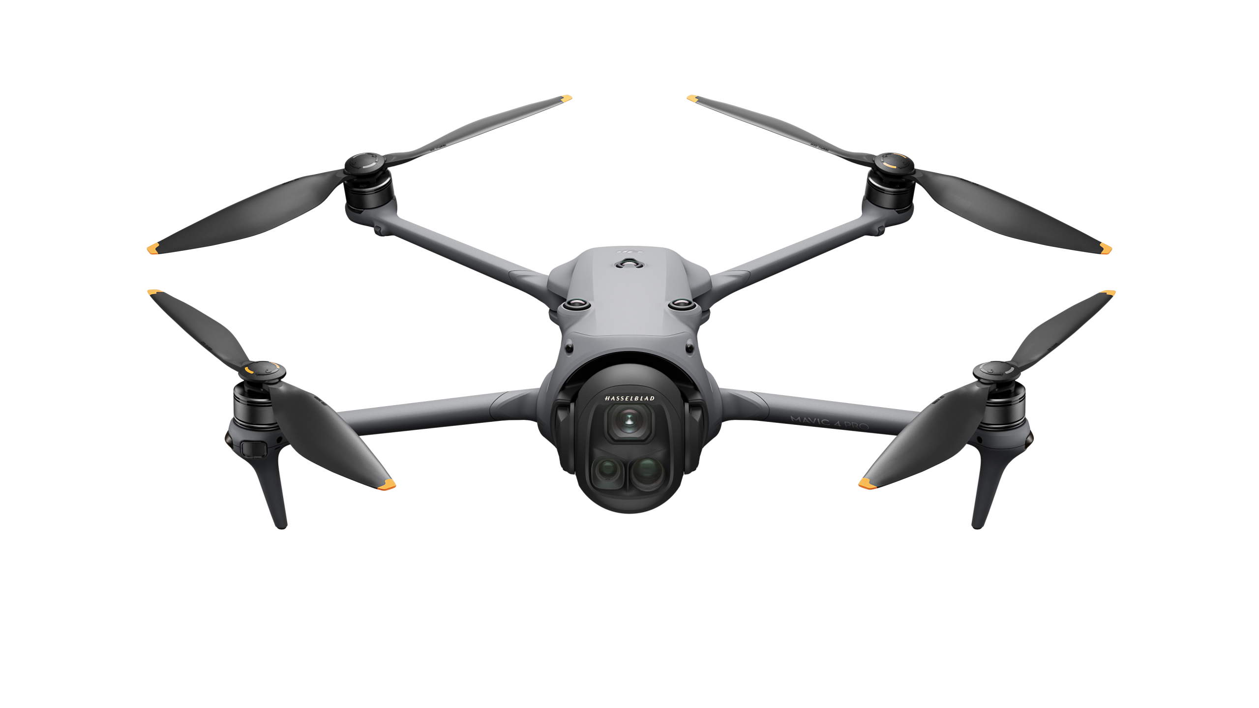
DJI Mavic 4 Pro · DJI Mini 5 Pro · DJI Air 3S · DJI Inspire 3 · DJI Avata 2 · DJI Neo 2 |
|
Software
|
DJI FlightHub 2 · DJI Terra · DJI Modify · PIX4Dmatic · PIX4Dsurvey |
|
Accessories
|
DJI D-RTK 3 · DJI D-RTK 2 · DJI O4 Ground Station · AP100 Parachute |
Rwanda's terraced, hilly terrain shapes platform choice. For agriculture, the Agras T25 and T50 with terrain-following and orchard modes handle slope spraying that ground equipment struggles with, while the Mavic 3 Multispectral maps crop health for variable-rate planning. For land administration and survey, the Matrice 350 RTK with Zenmuse P1 delivers cadastral-grade photogrammetry, and the Zenmuse L2 adds LiDAR where forest canopy defeats photography. For health logistics—Rwanda's signature use case—the FlyCart 30 and FlyCart 100 carry samples and supplies across terrain where roads are slow. For inspection and conservation, the Matrice 30T brings compact thermal and zoom capability. Aerosmart's pre-sale consultation matches airframe, payload and software to the mission and the 25 kg operating envelope. Because Rwanda's operations often run on steep terrain far from Kigali, we plan battery rotation, terrain-following calibration and spares provisioning into the initial package, so a team on a hillside or at a rural health post is not grounded waiting on a charge or a part. That readiness is what turns a compliant fleet into a dependable service.
Aerosmart supports operators nationwide, with concentrated demand in Kigali (survey, construction, health logistics, media), Musanze (agriculture, conservation, tourism), Rubavu (lakeside and border operations), and Huye, Muhanga, Nyagatare and the agricultural and conservation regions. We deliver, configure, register and support fleets wherever your operation is based, and our training teams travel to site.
Aerosmart Academy delivers on-site training across Rwanda—including Kigali, Musanze, Rubavu, Huye and the agricultural and conservation regions—structured around RCAA certification requirements and delivered on genuine DJI enterprise platforms. Training covers flight operations, payload and mission setup, survey and data workflows, and the registration, permit and pilot-certification steps operators need to fly legally and productively.
Whether the mission is a medical delivery, a terraced-field spray plan or a cadastral survey, the value in Rwanda sits in the output and its accuracy. Aerosmart supplies and configures the full DJI software chain so your fleet delivers reliably: FlightHub 2 for fleet management, mission planning and live operations; DJI Terra for photogrammetry, LiDAR processing and volumetric calculation; and PIX4Dmatic and PIX4Dsurvey for large-scale mapping and survey-grade deliverables. For land administration, survey captures process into orthomosaics, digital elevation models and cadastral-grade parcel outputs that export directly into the GIS platforms Rwanda's land agencies use; for agriculture, multispectral data becomes variable-rate prescription maps suited to sloped, terraced holdings; and for cargo operations, route and payload planning integrate into repeatable, auditable delivery workflows. We configure these during onboarding so your operators produce client-ready results from the first project.
01 Authorised DJI Enterprise Dealer. Genuine products, manufacturer warranty, firmware support and RCAA-compatible documentation.
02 Rwanda Delivery. Delivery to Kigali, Musanze, Rubavu and locations nationwide, with customs documentation support.
03 RCAA Regulatory Guidance. A written Rwanda-specific regulatory brief covering registration, activity permits and operator or pilot certification requirements.
04 Cargo and Health-Logistics Configuration. DJI FlyCart platform selection and workflow configuration for medical delivery and urgent logistics applications.
05 Terrain-Following Agriculture Setup. DJI Agras platform configuration for terraced farms, sloped terrain and precision agricultural applications.
06 On-Site Training. Aerosmart Academy provides on-site operational and product training anywhere in Rwanda.
07 Service Coordination. Remote diagnostics, repair routing and DJI Care Enterprise claims are managed directly.
Aerosmart Africa is an authorised DJI Enterprise and DJI Agriculture dealer supplying across Rwanda, with delivery to Kigali, Musanze, Rubavu and locations nationwide.
Yes. Operators need a UAS Activity Permit before starting operations, which may take around two to four weeks to process. For ongoing operations, an RPAS Operator Certificate valid for up to one year may also be required. Pilots must hold a Rwandan UAS pilot certificate, and the aircraft must be registered with the RCAA.
Foreign citizens cannot register drones directly. A Rwandan citizen, permanent resident or registered entity must register and operate the drone. The aircraft must also be declared to the Rwanda National Police upon entry.
Yes. The DJI FlyCart 30 can carry payloads of up to 30 kg, while the DJI FlyCart 100 can carry up to 100 kg, extending the medical-delivery model pioneered in Rwanda, subject to the relevant RCAA approvals.
The DJI Agras T25 and DJI Agras T50, with terrain-following and orchard modes, suit Rwanda's terraced and sloped fields. The DJI Mavic 3 Multispectral supports crop-health mapping and precision agricultural planning.
The DJI Matrice 350 RTK with the Zenmuse P1 is suitable for cadastral-grade photogrammetry, while the Zenmuse L2 supports LiDAR surveying where vegetation canopy or complex terrain limits photography. Both workflows can be paired with a D-RTK base station.
Yes. Aerosmart Academy delivers on-site training anywhere in Rwanda using genuine DJI enterprise platforms.
The general RCAA operating envelope allows aircraft up to 25 kg maximum take-off weight and operations up to approximately 120 m or 400 ft, subject to applicable approvals. Operations must also observe airport stand-off distances, visual-line-of-sight rules, night-flight restrictions and insurance requirements.
Pricing depends on the aircraft, payload, software, accessories and operational configuration required. Contact Sales@aerosmartglobal.com with your application requirements for a tailored quotation.
Yes. For repeatable site coverage, the DJI Dock 2 or DJI Dock 3 paired with a compatible enterprise aircraft can enable scheduled autonomous flights. Aerosmart configures the system around the operating location and the RCAA activity permits and approvals required for the deployment.

Fill in your details below and our team will get back to you
with a personalized quote.