
Africa's forests are among the continent's most important ecological and economic resources. The Congo Basin contains the world's second-largest tropical rainforest, while Afromontane forests and miombo woodlands support biodiversity, water regulation, carbon storage and local livelihoods across large areas of Central, Eastern and Southern Africa.
These forests face increasing pressure from agricultural expansion, illegal logging, charcoal production, fire and climate-related stress. DJI LiDAR, photogrammetry and autonomous drone systems can help forestry agencies, conservation organisations, carbon-project developers and commercial plantation operators collect repeatable aerial data across large and difficult-to-access areas.
LiDAR surveys can capture the vertical structure of forest canopies and the ground surface beneath vegetation where sufficient laser returns reach the lower layers. The resulting point clouds can be processed into canopy-height models and other structural metrics that support tree-height analysis, forest inventory and biomass estimation.
When LiDAR-derived measurements are combined with suitable field plots, species information and validated allometric models, they can support above-ground biomass and carbon-stock assessment. Final accuracy depends on forest type, canopy density, survey design, ground-control quality and the calibration data used in the estimation workflow.
Forest reserves across Africa may be affected by illegal logging, agricultural encroachment, charcoal production and unplanned road development. Detecting these changes early can help forestry teams investigate activity before the affected area expands.
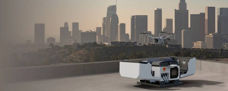
DJI Dock 3 can support scheduled repeat surveys along forest boundaries and selected high-risk zones. Comparing imagery from different dates can help identify new canopy gaps, access tracks and changes at the forest edge. Drone monitoring should be integrated with ground verification, enforcement procedures and applicable aviation regulations.
Commercial eucalyptus, pine, teak and other forestry plantations require regular estimates of stocking density, crown condition, growth and timber volume. Traditional ground inventory remains important, but it can be labour-intensive across large plantation estates.
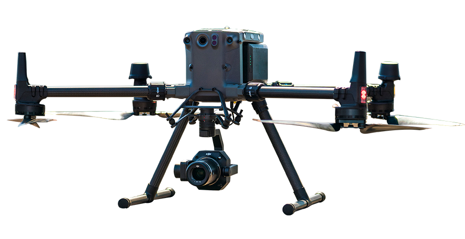
Photogrammetric surveys using the DJI Matrice 350 RTK with the Zenmuse P1 can produce detailed canopy-surface models and high-resolution orthomosaics. These datasets can support crown delineation, tree-count estimation, gap detection and plantation condition assessment when combined with suitable processing and field validation.
Forest and plantation fires require rapid assessment of the burned area, fire severity and canopy damage. Drone imagery can help forestry teams document affected areas sooner than ground-only inspection, particularly where access remains difficult or unsafe.
RGB and multispectral surveys can support burned-area mapping, vegetation-change analysis and restoration planning. The resulting maps may help distinguish areas of severe canopy loss from locations where vegetation is more likely to recover naturally. Final interpretation should be supported by field verification and appropriate ecological analysis.
REDD+ programmes and voluntary forest-carbon projects require consistent, transparent and verifiable monitoring of forest cover and carbon stocks. Repeat drone surveys can provide spatial records of canopy structure, disturbance and land-cover change within defined project areas.
Drone-derived data can support project documentation and monitoring, but it does not by itself guarantee acceptance under a specific carbon standard. Survey design, field calibration, uncertainty analysis and reporting should follow the methodology approved for the individual project and the requirements of the relevant validation or verification body.
Compare DJI enterprise drone platforms, payloads and processing tools for biomass estimation, illegal-clearing detection, plantation inventory and fire-damage assessment across Africa.
| Application | Platform | Payload / Software | Output |
|---|---|---|---|
| Biomass and carbon-stock assessment |
DJI Matrice 400
|
Zenmuse L3 | LiDAR canopy-height model, forest-structure data and biomass-estimation inputs |
| Illegal-clearing detection |
DJI Dock 3 with DJI Matrice 4D
|
DJI FlightHub 2 | Scheduled canopy surveys and weekly forest-change detection |
| Plantation inventory |
DJI Matrice 350 RTK
|
Zenmuse P1 | Crown delineation, tree-count estimation and stocking-density analysis |
| Fire-damage assessment |
DJI Matrice 4E
|
DJI Terra and compatible multispectral workflow | Fire-severity map, burned-area measurement and post-fire condition assessment |
DJI enterprise drones can support canopy-height mapping, above-ground biomass estimation, illegal-clearing detection, plantation inventory, fire-damage assessment and carbon-stock monitoring. Aerial surveys help forestry teams collect detailed information across large or difficult-to-access areas more efficiently than ground-only methods.
Yes. A LiDAR-equipped drone can capture detailed information about canopy height and forest structure. When combined with suitable field measurements and validated allometric models, this data can support above-ground biomass and carbon-stock estimation for forest-management and carbon-monitoring programmes.
Yes. DJI Dock 3 can support scheduled repeat surveys along forest boundaries and high-risk areas. Comparing imagery from different dates can help identify new canopy gaps, access tracks and signs of active clearing, allowing forestry teams to investigate changes before the affected area expands.
A DJI Matrice 400 with a compatible LiDAR payload is suitable for canopy-height and forest-structure mapping. The DJI Matrice 350 RTK with the Zenmuse P1 is suitable for photogrammetric plantation inventory and canopy mapping. DJI Dock 3 can support scheduled monitoring of forest boundaries and selected management zones.

Fill in your details below and our team will get back to you
with a personalised quote.