
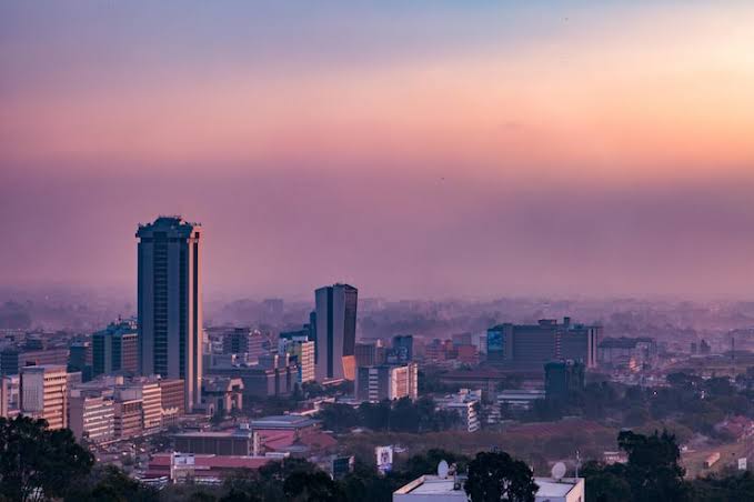
Zambia treats drones as full aircraft. The Zambia Civil Aviation Authority (ZCAA) regulates the sector under the Zambia Civil Aviation Regulations Part 18—Remotely Piloted Aircraft Systems—with mandatory registration, pilot licensing and operating approval for every drone, locally bought or imported. That rigour is a feature, not an obstacle: it gives Zambian businesses a firm legal footing to adopt drones commercially, particularly in the sectors where the value is highest.
Mining anchors that demand. Zambia is one of Africa's leading copper producers, and the Copperbelt and North-Western province operations rely increasingly on survey-grade aerial data for stockpile volumes, pit geometry and site monitoring. Alongside it, agriculture across the maize, tobacco and sugar belts, conservation across the great national parks, and tourism around Livingstone create a broad professional market.
What separates a productive fleet from an idle one is the support around it: correct platform selection, clean registration and import paperwork, licensed pilots, and a reliable service pathway. Aerosmart Africa is built around that full lifecycle rather than a single sale, which is why Zambian mines, agribusinesses and survey firms treat us as a long-term partner.
Aerosmart Africa supplies the complete DJI range into Zambia as an authorised DJI Enterprise and DJI Agriculture dealer, with delivery to Lusaka, Kitwe, Ndola and nationwide, ZCAA regulatory guidance, and on-site training across the country.
Copper and Mining: The Copperbelt (Kitwe, Ndola, Chingola, Mufulira) and North-Western operations around Solwezi require stockpile volumetric inventory, open-pit geometry, high-wall mapping, haul-road assessment and tailings monitoring. LiDAR is particularly relevant where vegetation and fragmented geometry defeat photogrammetry alone.
Agriculture: Maize, tobacco, sugar, soya and wheat across the central and southern regions present spraying, spreading and mapping requirements at field scales where aerial application delivers a clear economic advantage over manual methods.
Survey, Mapping and Construction: RTK mapping drones produce orthomosaics, elevation models and volumetrics for Zambia's construction, infrastructure and land projects, turning weeks of ground survey into a single flight day.
Conservation and Tourism: South Luangwa, Kafue and Lower Zambezi require monitoring over vast terrain, and the tourism sector around Livingstone and Victoria Falls generates aerial-content demand, both subject to the relevant permissions.
Utilities and Energy: Power, water and telecom operators inspect transmission lines, towers, dams and masts across long spans, cutting downtime and reducing risk.
Emeralds and Industrial Minerals: Zambia's gemstone and industrial-mineral operations add further volumetric survey and site-monitoring requirements to the mining base.
Drone operations in Zambia are regulated by the Zambia Civil Aviation Authority (ZCAA) under the Zambia Civil Aviation Regulations (ZCARs) Part 18. The points below are practical guidance, not legal advice; always confirm current requirements with the ZCAA or through Aerosmart's regulatory brief.
Certificate of Registration: Every drone must be registered with the ZCAA, regardless of whether it was bought locally or imported. A ZCAA officer physically inspects the drone, and a fire-resistant ID plate showing nationality and registration number is fixed to the aircraft.
RPAS Pilot's Licence (RPL): A remote pilot licence is required for the pilot, with age (18+), English-proficiency and medical requirements.
Letter of Approval (RLA): A Remote Pilot Aircraft Letter of Approval is required to operate.
RPAS Operator Certificate (ROC): Companies operating commercially require an ROC, with cost scaling to fleet size, plus flight logs, maintenance records and periodic ZCAA audits.
Zambia Air Force Airspace Permit: Beyond ZCAA approvals, operators apply to the Zambia Air Force for an airspace permit; foreign-registered RPAS require special authorisation.
Import and Operating Limits: Temporary import requires ZCAA inspection and Zambia Revenue Authority clearance, lodged at least one month ahead. Maximum altitude 120 m (394 ft) and not exceeding the highest object within a 300 m radius; VLOS with a 500 m horizontal limit; 10 km stand-off from airports; mandatory insurance; and no flights near sensitive sites such as prisons, police stations, crime scenes or key national facilities.
What Aerosmart provides: A written Zambia-specific regulatory brief covering registration and inspection, the RPL, RLA and ROC, the Zambia Air Force airspace permit, import clearance and operating limits, plus ZCAA-compatible documentation with every purchase.
Mining drives most enterprise demand. For large concessions, the Matrice 400 with Zenmuse L3 covers extensive LiDAR mapping in a single deployment; for standard pit and stockpile survey, the Matrice 350 RTK with Zenmuse L2 delivers centimetre-grade output with a D-RTK base station, and the Zenmuse P1 adds high-resolution photogrammetry. For agriculture, the Agras T50 suits large field crops and the T25 fits service providers and smaller holdings. For power and plant inspection, the Matrice 30T or Matrice 400 with the Zenmuse H30T combines thermal and long-range zoom. Copperbelt dust and heat make an IP-rated airframe and a dust-calibrated maintenance schedule a functional requirement—factors Aerosmart accounts for in pre-sale consultation.
Aerosmart supports operators nationwide, with concentrated demand in Kitwe, Ndola, Chingola and Mufulira (Copperbelt mining), Solwezi (North-Western mining), Lusaka (survey, construction, government), and Livingstone, Kabwe and Zambia's agricultural and conservation regions. We deliver, configure, register and support fleets wherever your operation is based, and our training teams travel to site.
Aerosmart Academy delivers on-site training across Zambia—including Lusaka, the Copperbelt, Solwezi and the agricultural regions—structured around ZCAA certification requirements and delivered on genuine DJI enterprise platforms. Training covers flight operations, LiDAR and payload workflows, mine-survey data processing, and the registration, licensing and airspace-permit steps operators need to fly legally and productively.
01 Authorised DJI Enterprise Dealer. Genuine products, manufacturer warranty, firmware support and ZCAA-compatible documentation.
02 Zambia Delivery. Delivery to Lusaka, Kitwe, Ndola and locations nationwide, with customs documentation support.
03 ZCAA Regulatory Guidance. A written Zambia-specific regulatory brief covering aircraft registration, RPL, RLA, ROC requirements and the applicable Air Force airspace permit.
04 Mining Survey Configuration. LiDAR and photogrammetry platform selection for Copperbelt surveying, stockpile measurement, pit mapping and mine-monitoring requirements.
05 Import and Inspection Support. Guidance through ZCAA inspection requirements and ZRA customs-clearance procedures.
06 On-Site Training. Aerosmart Academy provides on-site operational and product training anywhere in Zambia, including mining and industrial sites.
07 Service Coordination. Remote diagnostics, repair routing and DJI Care Enterprise claims are managed directly.
Aerosmart Africa is an authorised DJI Enterprise and DJI Agriculture dealer supplying across Zambia, with delivery to Lusaka, Kitwe, Ndola and locations nationwide.
Yes. Every drone must be registered with the ZCAA, whether purchased locally or imported. A ZCAA officer inspects the aircraft, and a fire-resistant identification plate is fixed to it.
Commercial operators require an RPAS Operator Certificate (ROC), a Certificate of Registration, an RPAS Pilot Licence (RPL) and a Letter of Approval (RLA). An airspace permit from the Zambia Air Force may also be required.
The DJI Matrice 350 RTK with the Zenmuse L2 is suitable for standard pit and stockpile surveying. For larger mining concessions, the DJI Matrice 400 with the Zenmuse L3 can be paired with a D-RTK base station for centimetre-grade positioning and survey workflows.
Yes, with temporary import clearance. The drone must be inspected by the ZCAA and cleared through the Zambia Revenue Authority. Applications should be submitted at least one month in advance, and Aerosmart provides import guidance with every purchase.
The general limit is up to 120 m or 394 ft above ground level, without exceeding the highest object within a 300 m radius. Operations must remain within visual line of sight and observe a 500 m horizontal limit and a 10 km stand-off from airports, unless otherwise authorised.
Yes. Aerosmart Academy delivers on-site training anywhere in Zambia, including mining and industrial sites, using genuine DJI enterprise platforms.
Pricing depends on the aircraft, payload, software, accessories and operational configuration required. Contact Sales@aerosmartglobal.com with your application requirements for a tailored quotation.

Fill in your details below and our team will get back to you
with a personalized quote.