
Every search and rescue operation is a race between time and terrain. The farther a missing person is from accessible routes, the longer the search takes, and the colder, more injured or more dehydrated that person may become with every additional hour spent covering ground. Africa's search and rescue environments—from the highland terrain of Ethiopia, Kenya and Rwanda to Tanzania's dense bush, the Rift Valley lake systems, the mangrove and delta terrain of Nigeria and Mozambique, and the desert margins of the Sahelian belt—include some of the most challenging search areas on Earth. Their scale can make it difficult for ground teams to provide full coverage within critical survival windows.
DJI enterprise drone systems from Aerosmart provide African search and rescue teams with thermal detection, night-time capability, GPS coordinate delivery and aerial cargo support. These capabilities can transform broad ground searches into targeted aerial detection followed by precise ground recovery.
Ground-based search operations in Africa face terrain, scale and resource challenges that can extend search durations beyond the survival windows that missing persons in extreme environments may be able to sustain.
In Kenya's Aberdare Ranges and Mount Kenya National Park, a missing hiker may be located several kilometres from the nearest trail in dense moorland vegetation that ground teams can cover only at walking pace. In Tanzania's Serengeti, a vehicle breakdown or a missing tourist may occur anywhere across approximately 14,750 square kilometres of open savanna—an area that cannot be searched systematically by a single ground team within a limited emergency response window.
In the Lake Victoria fishing communities of Kenya, Uganda and Tanzania, boats caught in sudden squalls may be located anywhere across a vast lake surface. In the Niger Delta, an injured fisherman within mangrove channels may remain hidden from searchers travelling by boat through a complex network of waterways.
A thermal drone can cover areas that ground teams cannot inspect quickly. It moves faster than a walking search party, supports night-time operations and can identify potential heat signatures in difficult terrain. It can also deliver the GPS coordinates of a detected survivor to recovery teams, converting a wide-area search into a navigation task with a known destination.
The Matrice 4T's rapid deployment capability and integrated thermal camera support an immediate aerial assessment of the initial priority area—the last known position and the most likely surrounding terrain—before a wider systematic search programme is designed and deployed. Human body heat may be detected at suitable operational altitudes in darkness, through gaps in partial vegetation cover and in reduced-visibility conditions.
A quick thermal pass over the last known position, the route between known waypoints and the terrain features where a person is most likely to shelter or become immobilised can provide an early aerial picture. This helps determine whether ground teams should concentrate on a specific location or expand the search area systematically.
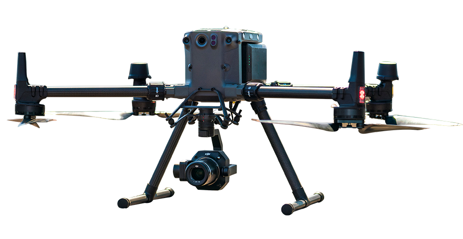
For systematic search operations covering multiple square kilometres of African bush, highland or coastal terrain, the Matrice 30T's extended flight time, IP55 weather resistance and subject-tracking capability provide sustained thermal aerial coverage for methodical search missions.
A search pattern can be designed in DJI Pilot 2 as a grid or corridor mission over the defined search area. The thermal camera can then cover the area at the designated search altitude and lane width. When a potential human-sized thermal signature is identified, the operator can maintain the camera view while assessing whether the detection is a survivor, an animal or a false alarm. GPS coordinates for confirmed detections can then be shared with ground recovery teams.
Hot-swappable batteries help maintain aerial search coverage across extended areas and reduce interruptions before the planned search pattern is completed.
Many incidents that lead to search and rescue activations are first reported in the late afternoon or evening—for example, a hiking group that has not returned by sunset, a vessel that has not reached its destination by nightfall or an individual who cannot be contacted at the end of the day. The most critical search hours are therefore often at night, when ground searches may be more difficult and the survivor may be increasingly vulnerable to exposure.
The Zenmuse H20N's starlight cameras and dual thermal zoom capability support night-time search operations across large areas. Its thermal imaging options provide both a wider overview for initial detection and a closer inspection view that can help verify a potential survivor before ground teams begin the recovery approach.
Once a survivor has been located, the immediate priority may be to keep that person safe until the recovery team arrives. Water, emergency food, thermal protection, a radio or medical supplies can help support the survivor during the interval between aerial detection and ground recovery.
The DJI FlyCart 30 can transport emergency supplies to a precise delivery point based on the survivor's GPS coordinates. In terrain where the recovery team may still be some distance away, an early supply delivery can provide essential support while rescuers travel to the location.
Once a survivor has been located, the Zenmuse V1 loudspeaker payload on a compatible aircraft can help establish voice contact from the air. Rescue teams can provide reassurance, confirm basic condition information and give navigation instructions towards a safer area or the approaching recovery team.
DJI enterprise drones equipped with thermal cameras can systematically search large areas of African terrain and identify potential human heat signatures in darkness and difficult-to-access locations. Once a potential survivor is detected, the drone can provide GPS coordinates to ground recovery teams. The DJI FlyCart 30 can deliver emergency supplies, while the Zenmuse V1 loudspeaker can support voice contact and navigation guidance from the air.
Yes. The DJI Matrice 400, when equipped with a compatible thermal and low-light payload such as the Zenmuse H20N, can support night-time search missions. Starlight cameras and thermal zoom capabilities help rescue teams identify and inspect potential targets in low-light or dark environments. Thermal searches may be particularly effective when there is a clear temperature difference between a person and the surrounding terrain.
The area covered during a single mission depends on the aircraft, payload, search altitude, lane width, terrain, weather and required image detail. Multiple sorties with hot-swappable batteries can extend the total coverage area. DJI FlightHub 2 can record completed flight paths and mission data, helping search coordinators reduce duplicate coverage and avoid gaps between adjacent search lanes.

Fill in your details below and our team will get back to you with a personalised quote.