
Urban fires across Africa create a complex operational environment for fire-service commanders. Internal layouts may be unknown, structural conditions can deteriorate rapidly, and crews may not be able to enter safely during the initial assessment. Decisions about access routes, appliance positioning, firefighting tactics and search priorities are often made from the incident perimeter, where smoke, heat, flames and surrounding structures can severely limit visibility.
Drone-based thermal and visual intelligence strengthens the incident command picture by providing an elevated view of roofs, upper floors, fire spread and exposed structures. A drone can transmit live imagery from a safe stand-off position, helping commanders assess changing conditions before committing personnel to higher-risk areas.
Urban fire risks vary considerably across African cities. Informal settlements in and around major urban centres may combine dense building layouts, restricted road access, combustible construction materials and high population density. These conditions can accelerate fire spread while making appliance access, evacuation and rescue operations more difficult.
Formal urban areas increasingly include multi-storey residential, commercial and mixed-use buildings whose internal layouts may not be immediately available to responding fire services. Port storage areas, informal markets, warehouses and mixed-use complexes can create similarly challenging incidents because the contents, occupancy conditions and internal hazards may be unknown when the first crews arrive.
In these environments, a thermal drone launched soon after arrival can provide an early overhead assessment of the structure, visible fire conditions, exterior hotspots and exposure risks before ground teams move closer to the hazard area.
The DJI Matrice 4T is a compact enterprise aircraft with a standard take-off weight of approximately 1,219 g. It combines wide-angle, medium-telephoto, telephoto and thermal imaging capabilities in a portable platform that can be deployed for rapid incident assessment.
During an urban fire response, the Matrice 4T can help teams examine visible exterior hotspots, roof heating, heat transfer between adjoining structures and changes in the fire perimeter. Its thermal view can also support the search for possible human heat signatures in smoke-obscured or exposed areas. Thermal cameras do not see through solid walls, so all detections must be interpreted and verified by trained response personnel.
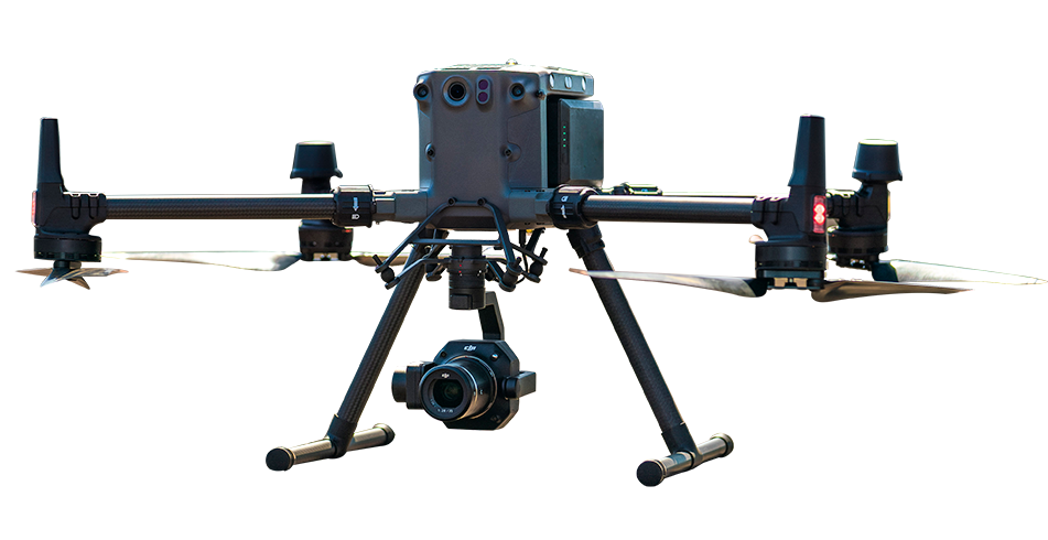
For larger fires and prolonged operations, the DJI Matrice 30T provides an advertised maximum flight time of up to 41 minutes and an IP55 protection rating. These capabilities make it suitable for structured fire-scene overwatch when supported by appropriate battery rotation, operational planning and safety procedures.
Its integrated thermal camera can help teams monitor the wider fire perimeter, track changing hotspots and identify adjacent structures experiencing increased thermal exposure. This aerial perspective can support appliance positioning, defensive operations, water supply coordination and exposure protection across a complex fire scene.
Major incidents, low-light operations and large or multi-storey structures may require greater endurance and more detailed visual and thermal observation. The DJI Matrice 400 offers an advertised maximum flight time of up to 59 minutes under specified test conditions and can be paired with the Zenmuse H30T multi-sensor payload.
The Zenmuse H30T provides 1280 × 1024 thermal video, a thermal channel with up to 32× digital zoom and a separate high-resolution visible-light zoom camera offering up to 34× hybrid optical zoom. This combination can help command teams observe elevated sections of a structure, inspect exterior hotspots and maintain situational awareness during demanding day or night operations.
Fire-seat and hotspot assessment: Thermal imaging can help identify visible heat concentrations, exterior hotspots and areas where heat is spreading across roofs, façades or adjoining structures.
Search support: Thermal cameras can help locate possible human heat signatures in smoke-obscured, exposed or partially visible areas. Any indication must be verified by trained search-and-rescue personnel.
Exposure monitoring: Repeated thermal observation of neighbouring structures can show where radiant heat is increasing, helping teams prioritise cooling and exposure-protection measures.
Structural observation: Aerial visual and thermal imagery can reveal roof damage, visible deformation, exterior cracking, collapse zones and abnormal heat patterns. It supports, but does not replace, assessment by qualified structural and fire-safety professionals.
Aerial coordination: Live streaming through DJI FlightHub 2 can share the same aerial view with command staff and authorised response teams, supporting coordinated decision-making across the incident.
DJI enterprise drones equipped with thermal and visual cameras can provide fire services with real-time aerial intelligence during structural and urban fire incidents. They can help teams assess visible hotspots, monitor fire spread, examine exposed structures and search for possible heat signatures from a safe stand-off position. The aerial view can also improve visibility when smoke, flames or building obstructions restrict ground-level observation.
Thermal drones can help identify possible human heat signatures in smoke-obscured, exposed or partially visible areas. However, thermal cameras cannot see through solid walls, and hot objects, reflected heat or building materials may produce similar thermal patterns. Drone observations should therefore support, rather than replace, established search-and-rescue procedures and verification by trained personnel.
The appropriate aircraft depends on the incident scale, required endurance, operating environment and available response resources. The DJI Matrice 4T is well suited to portable, rapid thermal assessment. The DJI Matrice 30T supports longer fire-scene overwatch with an advertised maximum flight time of up to 41 minutes and an IP55 rating. For major incidents requiring greater endurance and advanced multi-sensor observation, the DJI Matrice 400 paired with the Zenmuse H30T provides an advertised maximum flight time of up to 59 minutes, high-resolution thermal imaging and powerful visible-light zoom.

Fill in your details below and our team will get back to you with a personalised quote.