

Collecting aerial data is only the first stage of a professional drone workflow. Organisations also need suitable software to plan missions, manage aircraft, process imagery and LiDAR data, edit digital models, coordinate remote operations and produce reliable client deliverables.
Aerosmart supplies DJI software licences, compatible RTK equipment, enterprise accessories and workflow support for customers across African markets. Available solutions include DJI FlightHub 2 for fleet and remote-operation management, DJI Terra for mapping and data processing, DJI Modify for point-cloud and 3D-model refinement, and the D-RTK 3 Multifunctional Station for compatible positioning and survey workflows.
Aerosmart can also advise on compatible third-party applications, including PIX4Dmatic and PIX4Dsurvey, when a project requires large-scale photogrammetry processing, point-cloud vectorisation or CAD- and GIS-ready outputs. The appropriate combination depends on the aircraft, payload, dataset size, required accuracy, processing environment and final deliverables.
Remote and Low-Connectivity Workflows
Mining sites, agricultural estates, forestry concessions and rural
survey areas may have limited or unreliable internet access. DJI
Terra offers both online and offline licence options. With a
properly activated offline licence, paid processing functions can
be used on the bound workstation without a continuous internet
connection.
Consistent Mission and Fleet Records
Multi-site operations require clear records of aircraft status,
routes, mission activity and authorised media. DJI FlightHub 2 can
support mission planning, live operational awareness, remote
control of compatible systems, flight scheduling and centralised
fleet management. Available functions depend on the licence plan,
aircraft, Dock model and network configuration.
Reliable Positioning and Survey Control
Some project locations do not have convenient access to a network
RTK service or nearby survey-control infrastructure. The D-RTK 3
Multifunctional Station can operate in base-station, relay-station
and rover-station modes for compatible workflows. Final survey
accuracy still depends on correct setup, satellite conditions,
flight planning, processing and independent quality checks.
Professional Deliverables
Raw images and point clouds normally require processing and
refinement before they are suitable for engineering, planning,
mining, agriculture or asset-management workflows. The selected
software should support the required coordinate system, accuracy
checks, export formats, workstation capacity and client
documentation standards.
Aerosmart supplies DJI drone software, RTK equipment, intelligent batteries, charging solutions, remote controllers, compatible payloads and other enterprise accessories. Product-selection guidance, compatibility verification, setup support and training are available to help organisations build complete systems for surveying, mining, construction, agriculture, inspection, conservation, public safety and other professional applications.
DJI FlightHub 2 is a cloud-based drone-operations management platform offering remote control, intelligent flight scheduling, route management, live operational awareness and integration with compatible DJI aircraft and Dock systems. It can help authorised teams manage aircraft, plan repeatable missions, monitor operations and share approved information with command or project personnel.
Compatible functions can include Virtual Cockpit operation, scheduled Dock missions, livestreaming, media management and third-party integration. Feature availability varies by aircraft, Dock model, licence plan, region and system configuration. Automated functions remain subject to operator oversight, local aviation rules and the organisation's approved procedures.
Organisations requiring local control over operational data can evaluate DJI FlightHub 2 On-Premises. This is a separate deployment option designed to place the platform within customer-managed infrastructure. Suitability depends on the customer's security, server, integration and support requirements.
Connectivity at remote sites must be assessed before deployment. FlightHub 2 and compatible DJI Dock systems require a suitable network connection, and performance depends on coverage, bandwidth, latency, SIM and APN settings, network equipment and site configuration. Compatibility should not be assumed solely from the name of a mobile-network provider.
DJI Terra processes compatible aerial data into outputs such as 2D orthophotos, 3D reconstructions, point clouds, digital surface models and multispectral maps. It supports workflows involving compatible DJI photogrammetry cameras, Zenmuse LiDAR payloads and multispectral data.
Current DJI Terra capabilities also include next-generation 3D reconstruction technology such as Gaussian Splatting. Available functions depend on the software version, licence tier, sensor, dataset and workstation hardware.
DJI Terra is available with online and offline licence options. Online licences require internet access for paid functions, while a correctly exchanged and bound offline licence can use paid features without an internet connection. Teams working in remote locations should complete licence activation and workstation preparation before travelling to the site.
Processing performance depends on image count, point-cloud size, CPU, RAM, graphics memory, storage speed and selected reconstruction settings. A test workflow is recommended before committing to a large field programme.
DJI Modify is an intelligent editing application for point clouds and 3D models. It provides tools for point-cloud smoothing, noise reduction, downsampling and classification, together with functions for identifying and repairing mesh defects such as floating objects, holes and vehicles.
When integrated with DJI Terra, DJI Modify can support a more streamlined workflow from reconstruction to refinement. This is useful for teams preparing urban models, infrastructure records, construction documentation, heritage models and client-facing visual deliverables.
Editing improves the presentation and usability of a model, but it should not be used to obscure material survey information. Formal deliverables should retain appropriate processing records, validation results and version history.
The D-RTK 3 Multifunctional Station supports base-station, relay-station and rover-station modes. It receives signals from major GNSS constellations and can provide RTK correction data, extended transmission support and survey-point collection for compatible DJI enterprise workflows.
DJI specifies centimetre-level performance under defined RTK conditions, including horizontal accuracy of 0.8 cm plus 1 ppm in fixed-survey rover mode and network-RTK calibration accuracy of 1.0 cm plus 1 ppm horizontally. These are equipment specifications, not a guarantee of final map accuracy.
Final project accuracy depends on base-station coordinates, satellite visibility, baseline distance, aircraft and payload configuration, environmental conditions, processing and independent control or check points. Ground-control requirements should be determined by the responsible survey professional and the applicable national standard.
PIX4Dmatic is designed for local photogrammetric processing, including large-scale, corridor and terrestrial projects. It can generate geospatial outputs such as point clouds, orthomosaics and terrain products while supporting workflows that continue toward CAD- and GIS-ready deliverables.
PIX4Dsurvey bridges the gap between point-cloud data and CAD or GIS. It can import compatible Pix4D projects and LAS or LAZ point clouds, create terrain surfaces, vectorise features and export engineering deliverables in supported formats.
Aerosmart can help customers evaluate whether DJI Terra, PIX4Dmatic, PIX4Dsurvey or a combined workflow is more suitable for the required sensor, dataset size, processing environment and final output.
| Software / Hardware | What It Does | Example Use Case |
|---|---|---|
|
DJI FlightHub 2
|
Fleet management, mission planning, remote operations and DJI Dock coordination | Multi-site inspection, conservation patrol coordination, emergency response and remote-facility monitoring |
|
DJI Terra
|
Photogrammetry, LiDAR, multispectral and 3D reconstruction workflows | Surveying, construction earthwork, mining models, agricultural maps and remote-site processing |
|
DJI Modify
|
Point-cloud refinement, mesh repair, object removal and texture improvement | Urban models, infrastructure documentation, heritage projects and client-ready 3D deliverables |
|
D-RTK 3 Multifunctional Station
|
RTK correction, relay support and survey-point collection for compatible workflows | High-accuracy mapping, cadastral work, construction measurement and geospatial field programmes |
|
PIX4Dmatic
|
Local photogrammetry processing for large-scale, corridor and terrestrial projects | Large concessions, infrastructure corridors, city mapping and high-volume survey datasets |
|
PIX4Dsurvey
|
Point-cloud vectorisation, terrain modelling and CAD- or GIS-ready export | Land titling, topographic surveys, cadastral deliverables and engineering documentation |
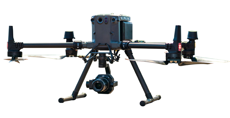
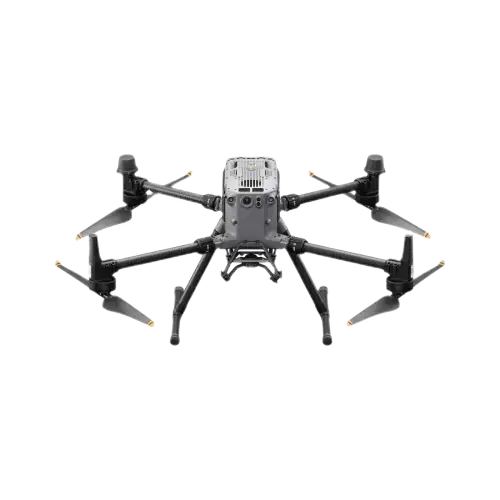

Aerosmart supports professional drone operators, survey teams, mining companies, agricultural organisations, infrastructure operators and public-safety agencies with genuine DJI licences, workflow consultation, multilingual technical support and compatible enterprise hardware.
Genuine Licences and Correct Activation
Aerosmart supplies genuine software licences with activation
guidance and access to the functions included in the selected
licence plan. Correct licensing helps customers avoid activation
problems, unavailable features and unsupported configurations.
Remote Technical Support
Aerosmart's technical team can assist with licence activation,
workstation preparation, workflow configuration, data processing
and troubleshooting. Support method, language, response time and
duration depend on the agreed support package.
Workflow and Compliance Orientation
Professional operations may involve requirements related to
aviation approval, privacy, data handling, surveying standards and
evidentiary records. Aerosmart can provide practical workflow
orientation, while customers remain responsible for obtaining
advice and approval from the relevant authorities and qualified
professionals.
Remote Activation and Hardware Delivery
Eligible software licences can be activated remotely. Compatible
hardware and accessories can be shipped from Dubai with available
product and export documentation. Availability, licence
compatibility, delivery time, duties and import requirements depend
on the selected solution and destination country.
Aerosmart supplies professional DJI software and compatible hardware solutions, including DJI FlightHub 2, DJI Terra, DJI Modify and the D-RTK 3 Multifunctional Station. Aerosmart can also advise on compatible third-party workflows involving PIX4Dmatic and PIX4Dsurvey. Availability and support depend on the selected product and destination.
Yes, when the appropriate DJI Terra offline licence has been exchanged and bound to the workstation. Online licences require a stable internet connection to use paid features. Teams planning remote work should complete activation and test the processing workstation before deployment.
DJI FlightHub 2 is used for compatible fleet management, route planning, live operational awareness, remote control, flight scheduling, DJI Dock management and third-party integration. Available functions depend on the connected equipment, licence plan and network configuration.
FlightHub 2 and compatible DJI Dock systems can use a suitable internet connection provided through supported wired or cellular equipment. Operation depends on coverage, bandwidth, latency, SIM and APN settings, network hardware and site configuration. A technical connectivity assessment is recommended before deployment.
The D-RTK 3 is a multi-mode GNSS station that can provide RTK correction data, relay support and survey-point collection for compatible DJI workflows. Centimetre-level positioning may be achievable under suitable conditions, but final mapping accuracy depends on setup, satellite visibility, flight planning, processing and independent validation.
DJI Terra is closely integrated with compatible DJI photogrammetry, LiDAR and multispectral workflows. PIX4Dmatic is designed for local photogrammetric processing, including large-scale, corridor and terrestrial projects. The correct choice depends on the sensor, dataset, required outputs, workstation and existing GIS or CAD workflow.
Yes. Training can cover DJI Terra processing, FlightHub 2 onboarding, DJI Modify editing, D-RTK 3 setup and compatible Pix4D workflows. Remote or agreed in-person programmes may be available in English, French or Arabic, depending on scope, location and availability.
DJI Terra licences are available from Aerosmart for professional customers across the African markets it serves. The appropriate licence depends on the required functions, activation method, device count and project workflow. Contact africa@aerosmart.ae for current pricing and configuration guidance.

Fill in your details below and our team will get back to you with a personalised quote.