
Africa's built and archaeological heritage represents one of the world's richest concentrations of human cultural history. It includes Ethiopia's Lalibela rock-hewn churches and Axum obelisks, Mali's Timbuktu earthen mosques, Egypt's ancient monuments, Great Zimbabwe's stone structures, the Nubian pyramids of Sudan, the Swahili coastal settlements of Kenya and Tanzania, and thousands of archaeological sites that document more than 200,000 years of human history and civilisation. This heritage is irreplaceable, yet it remains at risk from climate-related weathering, urban development, conflict, looting and the gradual deterioration of historic materials.
Documenting these sites before further deterioration occurs is an urgent priority for African heritage conservation agencies, UNESCO World Heritage site managers, university archaeology departments, national museums and antiquities authorities. Accurate, dimensionally complete and visually detailed 3D records preserve a structure's geometry and condition at a specific point in time. These records can support conservation planning, restoration, research and public education, regardless of what later happens to the physical structure.
DJI enterprise drones provide an efficient and accurate solution for this documentation work. They can capture the complete 3D geometry of heritage structures at centimetre-level accuracy from multiple angles, including areas that may be difficult or unsafe to access from the ground. Drone-based documentation also reduces the need for physical contact with fragile structures.
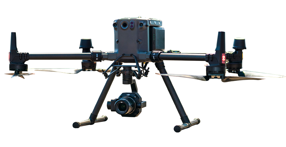
The DJI Matrice 350 RTK equipped with the Zenmuse P1 can support the multi-angle image acquisition required for complete 3D reconstruction. Smart Oblique Capture helps document roofs, facades, internal courtyards, carved stone surfaces, decorated earthen walls and multi-level architectural features without requiring manual gimbal-angle adjustment for every flight pass.
DJI Terra can process the captured images into a dimensionally accurate and photorealistic 3D model of the documented structure. Carved details, masonry joints and visible surface textures can be preserved within the model. The resulting dataset can be measured, viewed from different angles and examined in compatible 3D software, creating a permanent digital record of the site's geometric and visual condition.
Repeat photogrammetric surveys can support deterioration monitoring at heritage sites. Examples include an earthen mosque losing surface plaster, a rock-hewn church developing structural cracks or a coastal Swahili ruin experiencing erosion. Surveys conducted at defined intervals can produce comparable 3D models that help identify where deterioration is occurring and where conservation intervention may be most urgently required.
Comparing a current 3D model with an earlier survey can reveal which surface areas have changed, how much material may have been lost and whether the rate of deterioration appears stable or is accelerating. This evidence can support conservation planning, funding applications, UNESCO reporting and national heritage authority prioritisation.
At active archaeological excavations across Africa, drone photogrammetry can document the excavation surface at each stratigraphic layer. This creates a spatial record of feature distribution, artefact positions and excavation geometry for post-excavation analysis, interpretation and publication.
The DJI Matrice 4E provides a portable and rapidly deployable photogrammetric survey option for active excavation sites. The excavation surface can be photographed systematically at the end of each working day, creating a complete 3D record of exposed features before the next stage of excavation removes or modifies them. In this way, each level of the stratigraphic sequence can be preserved digitally.
Ethiopia's Lalibela churches are eleven rock-hewn UNESCO World Heritage structures carved from volcanic rock. They face ongoing risks associated with water infiltration, structural stress and surface weathering. Drone photogrammetry can provide a detailed baseline record of each church's internal and external geometry for conservation management and structural intervention planning.
Timbuktu's historic earthen architecture, including the Djingareyber, Sankore and Sidi Yahia mosques, is vulnerable to surface erosion and weather-related deterioration. Drone-based condition documentation can help identify and quantify areas that require priority conservation work.
Kenya's Gede ruins, Tanzania's Kilwa Kisiwani and the Swahili architectural heritage of Lamu Old Town face a combination of vegetation encroachment, coastal weathering and development pressure. Timely 3D documentation can provide an important baseline for conservation planning and long-term monitoring.
DJI enterprise drones capture high-resolution images from multiple angles to create detailed 3D models of heritage structures and archaeological sites. These models provide permanent digital records of a site's geometry, architectural features and surface condition, helping preserve its historical character even if the physical structure deteriorates over time.
Yes. Repeat drone photogrammetry surveys conducted at scheduled intervals can produce comparable 3D models. Change-detection analysis can then help identify surface-material loss, crack progression, erosion and structural deformation between survey dates. This information supports conservation planning, maintenance prioritisation and funding applications.
The DJI Matrice 350 RTK equipped with the Zenmuse P1 is suitable for detailed documentation of large heritage structures and archaeological sites. Its Smart Oblique Capture workflow supports multi-angle image collection for creating accurate, photorealistic 3D models. The DJI Matrice 4E is a more portable alternative for smaller structures and active archaeological excavation sites. Final accuracy depends on flight planning, survey control, processing methods and site conditions.

Fill in your details below and our team will get back to you
with a personalised quote.