

A mine is more than the pit itself. It is a network of interconnected surface infrastructure that includes conveyor systems, crushing and screening plants, haul roads, water-management facilities, electrical distribution networks, processing plants and supporting structural assets. The condition of this infrastructure directly affects production continuity, operational safety and maintenance costs.
A failed conveyor, damaged haul-road section, structural defect or water-management issue can interrupt production as significantly as a problem within the mining operation itself. DJI enterprise drones help mining teams inspect these assets more frequently while reducing the need for personnel to work close to moving machinery, elevated structures or active heavy-vehicle routes.
Major mining operations across Africa rely on conveyor systems that may extend for hundreds of metres or several kilometres. These systems require regular inspection of belt condition, idler frames, structural supports, transfer points and material-spillage areas. Early identification of defects can support preventive maintenance and reduce the risk of unplanned stoppages.
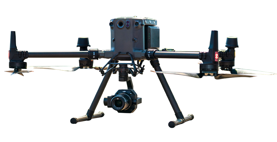
Ground-level inspection may require maintenance personnel to walk beside operating conveyors and work close to moving mechanical systems. A DJI Matrice 30T can provide detailed visual and thermal inspection data from a controlled aerial distance, helping teams identify visible belt damage, failed components, spillage accumulation and structural anomalies without entering the active conveyor zone.
Mine haul roads carry extremely heavy vehicles and are exposed to continuous loading, dust, drainage issues and surface degradation. Potholes, edge failure, blocked drainage channels and incorrect cross-fall can affect truck productivity, tyre wear, fuel use and vehicle stability.
Drone photogrammetry can produce digital surface models of haul-road networks for condition assessment, maintenance planning and cross-fall analysis. These datasets help road-maintenance teams identify deteriorating sections and prioritise grading, drainage correction and surface repair before conditions begin to affect operations.
Crushing plants, screening stations, thickener tanks and supporting steelwork require periodic inspection for corrosion, deformation, fatigue cracking and mechanical wear. Many of these areas are difficult to inspect from ground level without scaffolding, elevated platforms or rope access.
The DJI Matrice 30T and DJI Matrice 400 equipped with a compatible zoom and thermal payload can inspect elevated plant structures from a safe aerial distance. High-resolution zoom imagery can support the review of structural connections, corrosion areas and visible wear, while thermal imaging can help identify abnormal heat patterns associated with electrical faults, bearing overheating and other developing equipment issues.
For mine sites that require repeated monitoring of dispersed assets, such as conveyor routes, haul roads, perimeter fencing and water-management structures, DJI Dock 3 can support scheduled autonomous flights. Mission data can be reviewed in DJI FlightHub 2, helping maintenance teams identify changes and prioritise inspection or repair work without deploying a flight crew for every mission.
DJI enterprise drones equipped with zoom and thermal cameras can inspect conveyor systems, haul roads, processing-plant steelwork and other surface infrastructure from a safe aerial distance. This reduces the need for maintenance personnel to work close to moving machinery, elevated structures or active heavy-vehicle routes while still providing detailed visual and thermal inspection data.
Yes. A thermal payload such as the Zenmuse H30T can help identify abnormal heat patterns associated with bearing overheating, electrical faults and other developing equipment issues. These inspections can support preventive maintenance by helping teams identify potential failures before they result in unplanned shutdowns. Thermal inspections are generally most useful when equipment is operating under normal load and temperature conditions.
The DJI Matrice 350 RTK equipped with the Zenmuse P1 is suitable for photogrammetric haul-road surveys, digital surface models and detailed condition mapping. For faster visual and thermal inspections of road-surface defects, drainage channels and surrounding hazards, the DJI Matrice 30T may be a practical option. The final platform should be selected according to the required detail, inspection frequency, survey area and deliverable format.

Fill in your details below and our team will get back to you
with a personalised quote.