
Africa's road and rail bridge infrastructure represents a critical vulnerability in the continent's transportation network, and a maintenance challenge that the gap between bridge inspection frequency requirements and available inspection resource has allowed to accumulate across many national bridge portfolios. The consequences of inadequate bridge inspection are not theoretical: bridge failures on African roads occur with a frequency that reflects the combination of ageing infrastructure, inadequate maintenance funding, and inspection regimes that have been resource-constrained for decades.
Bridge inspection using traditional methods—inspector access via elevated work platforms, rope access from the deck above, or boat-based inspection of substructure elements below, is expensive, slow, disruptive to traffic, and hazardous for the inspection personnel working in proximity to both traffic and the structural elements under examination. For water crossing bridges where substructure access requires boat deployment, the inspection logistics add another layer of cost and complexity.
DJI enterprise drone inspection provides the below-deck, below-chord, and all-surface bridge structural documentation that formal bridge condition assessment requires—without closing the bridge to traffic, without deploying access platforms, and without inspection personnel working at height or in proximity to live traffic.
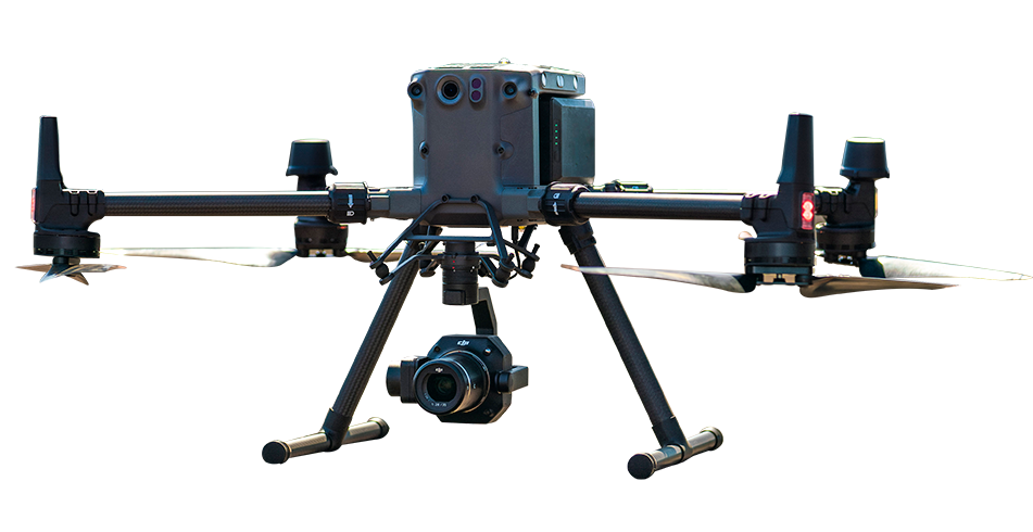
For routine bridge deck condition inspection—pavement condition, expansion joint status, parapet condition, drainage system function, and the visible signs of structural distress in deck slab surfaces the DJI Matrice 30T's compact deployment capability and integrated zoom camera provides the rapid surface documentation that routine bridge condition monitoring requires.
A single inspection flight at deck level with the Matrice 30T documents the complete bridge deck surface in minutes, at the zoom resolution that crack width estimation, spalling extent mapping, and drainage blockage identification require for formal inspection records. The georeferenced imagery from each inspection flight is compared against the previous inspection data in DJI FlightHub 2, helping identify new cracks, extending spalls, and condition deterioration between inspection dates.
Complete bridge structural condition assessment—covering the underside of deck slabs, the soffit of beam and slab superstructures, abutment faces, pier columns and caps, and the transition zones between structural elements where stress concentrations produce the earliest deterioration indicators requires an aircraft that can navigate below the deck structure, maintain stable hover in the confined spaces between structural elements, and produce the close-range high-resolution imagery that crack identification and structural damage classification demand.
The DJI Matrice 400's obstacle sensing system, including rotating LiDAR and omnidirectional sensing enables safe operation beneath bridge decks in the confined, obstacle-rich space below the superstructure while helping the pilot maintain situational awareness around complex structural elements. All operations must follow local aviation rules, including applicable visual-line-of-sight requirements. The Zenmuse H30T's 34× zoom documents fine crack widths in concrete surfaces, possible delamination patches in deck soffits, bearing condition at pier tops, and the structural condition of bridge elements that visual inspection from ground level or deck level cannot access at useful observation angles.
The H30T's thermal camera may help reveal temperature anomalies associated with moisture retention, delamination or other subsurface conditions in concrete bridge elements. Thermal findings should be treated as screening indicators and verified by qualified engineers using appropriate contact-based or non-destructive testing methods.
For bridge rehabilitation projects, historical structure documentation, and the formal as-built condition records that major bridge maintenance programmes require as baseline reference the DJI Matrice 350 RTK with Zenmuse P1 Smart Oblique Capture produces the complete 3D photogrammetric model of the bridge structure.
Every bridge element deck, parapets, beams, piers, abutments and substructure—is captured in the multi-angle Smart Oblique dataset and reconstructed into a dimensionally accurate 3D model at centimetre accuracy. Rehabilitation engineers measure structural dimensions directly from the model, identify geometric anomalies in pier verticality and bearing alignment, and produce formal condition drawings from the 3D dataset without requiring manual measurement access to each element.
Africa's road bridges across the Tana River in Kenya, the Rufiji in Tanzania, the Volta in Ghana, and the numerous bridges on Nigeria's federal road network represent structures where the gap between required and actual inspection frequency is largest, and where drone inspection's ability to conduct thorough inspection without traffic closure and access platform deployment most directly addresses the resource constraint.
Rail bridges on the Kenya-Uganda standard gauge and metre gauge networks, Tanzania's TAZARA railway line, Zambia's Copperbelt rail infrastructure, and the heritage railway structures of East Africa's colonial-era rail network all require inspection programmes that DJI drone systems can conduct more frequently and more thoroughly than the current inspection regime achieves with traditional methods.
DJI enterprise drones can inspect bridge-deck surfaces, superstructure soffits, pier columns, abutment faces and other substructure elements using high-resolution visual and zoom cameras. They can capture detailed imagery from close range without requiring extensive access platforms or, in many cases, a complete bridge closure. The collected data helps inspection teams document cracks, corrosion, concrete deterioration, displaced components and other visible structural conditions. All findings should be reviewed and confirmed by qualified bridge-inspection professionals.
Yes. Suitable DJI enterprise drones can inspect accessible areas beneath bridge decks, including soffit surfaces, beams, beam-to-deck interfaces, bearings, pier caps and other structural components that are difficult to observe from road level. Advanced obstacle-sensing systems can support controlled operation around complex structures, although flight conditions beneath a bridge may be affected by restricted space, low light, wind, water, magnetic interference and limited satellite positioning. Each underside inspection should therefore be supported by a site-specific risk assessment and mission plan.
Drone inspection can replace rope access for many routine visual-condition surveys, crack-mapping activities and surface-documentation tasks. It can reduce inspection time, minimise traffic disruption and limit personnel exposure to work-at-height and over-water hazards. Traditional access methods may still be required when inspectors need to touch the structure, measure a defect directly, perform non-destructive testing, collect concrete samples or carry out repairs. In practice, drone data helps teams identify and prioritise the specific areas that require closer manual inspection.

Fill in your details below and our team will get back to you
with a personalised quote.