
Africa faces a wide range of emergencies, including floods, cyclones, wildfires, landslides, industrial incidents and humanitarian crises. During these events, rapid situational awareness is essential for protecting lives, coordinating emergency services and supporting informed operational decisions.
DJI enterprise drones can provide emergency teams with a rapid aerial view of affected areas. They help incident commanders assess road access, infrastructure damage, flood extent, fire behaviour, isolated communities and other operational priorities without immediately placing personnel in unsafe locations.
Aerosmart supplies DJI enterprise drone platforms, thermal and zoom payloads, aerial broadcasting solutions, cargo-delivery systems and fleet-management software for emergency-response workflows across Africa. Final system selection depends on the incident type, operating area, payload requirement, terrain, weather, communication coverage and local aviation regulations.
Emergency-response operations across Africa are shaped by large geographic areas, difficult terrain, limited road access and infrastructure that may become unavailable during a major incident. Drone systems can help agencies collect timely information and improve coordination across these challenging environments.
Tropical cyclones: Coastal areas in Eastern and Southern Africa can experience severe wind, flooding and infrastructure damage. Drones can help assess affected settlements, identify blocked routes and support the prioritisation of emergency resources.
Seasonal flooding: Flood events can isolate communities, damage roads and bridges and make ground assessment difficult. Aerial thermal and visual data can help teams map flood extent, monitor changing conditions and locate people requiring assistance.
Drought and humanitarian response: Drought and food-security operations may cover large areas with limited transport access. Drones can support site assessment, logistics planning, infrastructure inspection and delivery planning for remote communities.
Earthquakes and structural collapse: Thermal imaging, optical zoom and aerial mapping can support rapid building-damage assessment, access-route planning and search operations after structural failures.
Industrial and infrastructure incidents: Fires, chemical releases, dam incidents, mining emergencies and oil-and-gas events can expose responders to hazardous conditions. Drones can provide remote visual and thermal intelligence while helping teams maintain a safer operating distance.
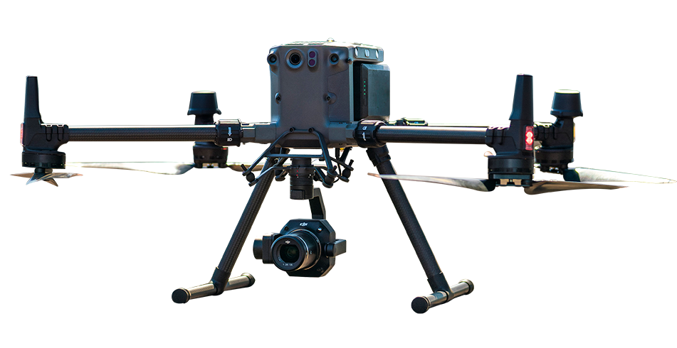
The DJI Matrice 30T is designed for rapid field deployment and integrates wide-angle, zoom and thermal imaging capabilities in one compact enterprise platform. It is suitable for initial incident assessment, night operations, fire monitoring and search-and-rescue support.
Emergency teams can use its thermal camera to investigate possible heat signatures, its zoom camera to inspect damaged structures and inaccessible routes, and its laser rangefinder to support accurate location reporting. DJI FlightHub 2 can provide live operational visibility for authorised personnel working from an emergency operations centre.
Actual thermal-detection performance depends on line of sight, surface temperature, weather, smoke density, surrounding heat sources, obstructions and the operating environment. Drone data should support, not replace, established search-and-rescue procedures.
For incidents covering wider areas, the DJI Matrice 400 with the Zenmuse H30T supports long-endurance operations, high-zoom observation and thermal assessment. This combination can help teams inspect large flood zones, wildfire boundaries, transport corridors and damaged infrastructure from a safe aerial position.
The system is suitable for missions that require detailed visual inspection at distance, broader-area situational awareness and coordinated operations across multiple response locations. Performance depends on mission planning, visibility, weather, transmission conditions and local flight restrictions.
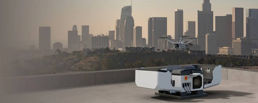
DJI Dock 3 with compatible DJI Matrice 4D or 4TD aircraft can support scheduled and remotely managed monitoring missions. It can be used at flood-prone areas, industrial facilities, critical infrastructure and other high-risk locations where repeatable aerial observation is valuable.
Scheduled visual and thermal missions can help agencies monitor developing hazards, compare conditions over time and maintain a consistent operational picture. Autonomous operations require suitable site preparation, communication coverage, approved procedures and compliance with national aviation requirements.
When communities are isolated by flooding, landslides, damaged roads or other access restrictions, DJI FlyCart platforms can support the transport of medical supplies, communication equipment, rescue tools, food and other essential cargo to suitable delivery locations.
Depending on the aircraft configuration and mission, cargo may be delivered by landing or through a compatible winch system. Payload and range depend on battery configuration, altitude, weather, terrain, route, reserve requirements and the approved operating plan.
Post-cyclone rapid assessment: Aerial surveys can help map damaged roads, bridge failures, affected settlements and isolated communities after severe weather events. This information can support logistics planning and resource prioritisation.
Flood monitoring and evacuation support: Drones can monitor flood progression, identify inaccessible areas, support searches for stranded people and assist teams in planning safer evacuation and response routes.
Search and rescue: Thermal and zoom-equipped drones can support missing-person searches, night operations and visual inspection of hazardous or inaccessible terrain. All findings should be verified through established rescue protocols.
Wildfire response: Thermal mapping can help teams observe fire boundaries, identify hotspots, assess access routes and monitor areas that may present a risk to firefighters and nearby communities.
Disaster documentation and damage assessment: Drone imagery can support mapping, insurance documentation, reconstruction planning, donor reporting and the creation of a consistent spatial record of affected areas.
Compare DJI enterprise drone platforms, payloads and software for rapid incident assessment, extended-area monitoring, emergency supply delivery, aerial broadcasting and autonomous operations across Africa.
| Application | Platform | Payload / Software | Key Capability |
|---|---|---|---|
| Rapid initial assessment |
DJI Matrice 30T
|
Integrated thermal and zoom cameras | Rapid deployment for day-and-night situational awareness and thermal incident assessment |
| Extended-area coverage |
DJI Matrice 400
|
DJI Zenmuse H30T | Long-endurance operations, thermal imaging and high-zoom observation |
| Emergency-supply delivery |
DJI FlyCart 30 / DJI FlyCart 100
|
Cargo box or compatible winch system | Delivery of essential supplies to suitable locations where ground access is difficult, delayed or unsafe |
| Public-safety broadcasting |
DJI Matrice 400
|
DJI Zenmuse V1 | Voice broadcasting for evacuation instructions, crowd guidance and emergency communication |
| Autonomous monitoring |
DJI Dock 3 with DJI Matrice 4D / 4TD
|
DJI FlightHub 2 | Scheduled and remotely managed missions for repeatable monitoring and hazard observation |
| Fleet coordination |
Compatible DJI enterprise platforms
|
DJI FlightHub 2 | Centralised mission coordination, live information sharing and multi-team operational visibility |
DJI enterprise drones can support emergency teams with rapid aerial assessment, live situational awareness, thermal searches, infrastructure-damage inspection, evacuation broadcasting and emergency-supply delivery. They can help incident commanders assess floods, fires, cyclones, landslides and other emergencies while reducing the need to immediately place personnel in unsafe areas.
Yes. Thermal-equipped systems such as the DJI Matrice 30T and the DJI Matrice 400 with the Zenmuse H30T can help search teams investigate heat signatures in low-light, night-time and visually challenging environments. Detection performance depends on weather, line of sight, surface temperature, smoke, obstructions and the surrounding environment.
Yes. DJI FlyCart platforms can transport medical supplies, food, communication equipment, rescue tools and other essential cargo to suitable delivery locations where roads are damaged, blocked or unsafe. Payload and range vary according to aircraft configuration, altitude, weather, route and safety requirements.
Yes. Compatible DJI enterprise platforms can carry speaker payloads for public-safety messaging, evacuation guidance, crowd direction and communication with people in remote or hazardous areas. Broadcasting clarity depends on the payload, aircraft altitude, wind, surrounding noise and terrain.
Integrated enterprise drones such as the DJI Matrice 30T are designed for rapid field deployment. Actual preparation time depends on battery readiness, aircraft checks, mission planning, weather, site conditions and aviation approval.
DJI FlightHub 2 provides tools for mission planning, remote operations, flight scheduling, live video, map annotations, data sharing and fleet coordination. This can help multiple teams maintain a shared operational picture during an incident.
Selected DJI enterprise platforms are designed for demanding environments, but flights must remain within the aircraft's stated operating limits. Wind, rain, heat, smoke, visibility, electromagnetic interference and landing-zone conditions should be assessed before every mission.
Aerosmart supports emergency-response drone enquiries across multiple African markets. Product availability, import documentation, training, aviation approvals and after-sales support vary by destination. Customers should confirm the current requirements for their country and proposed operation.
Yes. Requirements differ by country and may include aircraft registration, operator certification, flight permission, insurance and additional authorisation for night operations, flights over populated areas or operations beyond visual line of sight.

Fill in your details below and our team will get back to you
with a personalised quote.