
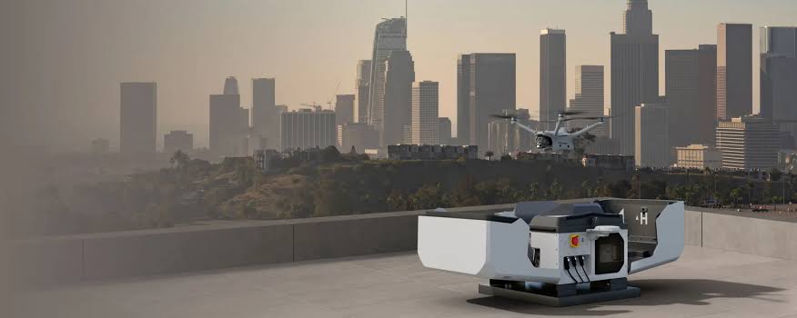
Public-safety teams often need to assess a developing incident before personnel move into an unfamiliar or high-risk environment. Dense urban neighbourhoods, large public spaces, remote terrain, border areas and complex road networks can all restrict what commanders and ground teams can observe from street level.
DJI enterprise drones can provide an elevated view using visible, zoom and thermal cameras. Live aerial imagery can help authorised teams understand site layout, identify access routes, monitor areas that are difficult to observe from the ground and coordinate personnel from a shared operational picture.
Aerosmart supplies DJI enterprise platforms, payloads and software for public-safety and professional operations across Africa. Platform selection should be based on the mission environment, required endurance, sensor capability, local aviation requirements and the organisation's approved operating procedures.
Ground-only operations can create three related challenges: restricted coverage, fragmented information and increased exposure to unknown conditions.
Restricted coverage: Ground personnel can observe only the areas they can physically reach or see. Large compounds, crowded markets, multiple city blocks, remote terrain and extended perimeters may contain blind spots that are difficult to monitor simultaneously.
Fragmented information: Updates from multiple teams may reach the command post through separate radio or voice reports. An authorised live aerial feed can provide commanders and field teams with a more consistent view of the same developing incident.
Exposure to unknown conditions: Personnel approaching an unfamiliar location may have limited information about access points, obstructions, terrain or activity beyond their line of sight. A drone can support preliminary assessment from a safe stand-off position before ground teams advance.
The DJI Matrice 4T is a compact enterprise aircraft suited to portable rapid-response operations. Its standard take-off weight is approximately 1,219 g with propellers, and its advertised maximum flight time is up to 49 minutes under specified windless test conditions. Actual endurance varies with weather, flight profile, accessories and operating conditions.
The integrated sensor system includes wide-angle, medium-telephoto, telephoto and thermal cameras, together with a laser rangefinder offering a specified measurement range of up to 1,800 m under defined conditions. These capabilities can help teams assess a location, examine distant areas, mark points of interest and observe heat differences in low-light or visually obscured environments.
Thermal imaging detects differences in surface temperature; it does not see through solid walls, buildings or other opaque obstacles. Thermal observations should therefore be interpreted alongside visible imagery and verified through established public-safety procedures.
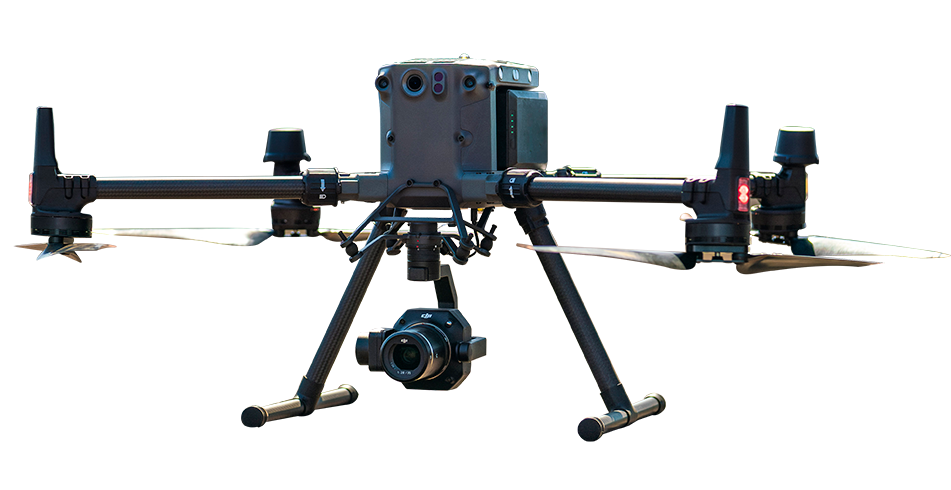
The DJI Matrice 30T combines an integrated wide camera, zoom camera, thermal camera and laser rangefinder in a weather-resistant platform. It has an IP55 protection rating and an advertised maximum flight time of up to 41 minutes under specified test conditions.
The platform can support longer incident observation, perimeter monitoring and coordinated public-safety operations. Battery sets can be replaced between flights to continue an extended mission, subject to battery-management procedures, operating conditions and the organisation's safety requirements.
Features available through compatible DJI applications, including location marking and Smart Track where supported, can help operators maintain awareness of moving objects and points of interest. These tools assist the operator but do not replace active piloting, verification or human decision-making.
For planned operations requiring greater endurance and advanced multi-sensor observation, the DJI Matrice 400 can be paired with the Zenmuse H30T. The Matrice 400 offers an advertised maximum flight time of up to 59 minutes when carrying the H30T under specified test conditions.
The Zenmuse H30T combines a 40 MP zoom camera with up to 34× optical zoom, a 48 MP wide-angle camera, a 1280 × 1024 thermal camera, an NIR auxiliary light and a laser rangefinder with a specified measurement range of 3 m to 3,000 m. Actual range and image performance depend on visibility, weather, target reflectivity, distance and the operating environment.
Night Scene Mode, thermal imaging and NIR illumination can improve observation in low-light conditions. They do not guarantee positive identification in complete darkness or through obstructions, and all observations should be assessed by trained personnel.
Mission planning and execution: Using DJI Pilot 2, an operator can add a location to the map as a GPS reference point and use the corresponding augmented-reality marker to support navigation toward the area of interest. Operators can switch between compatible visible and thermal views, mark locations of interest and use supported tracking tools while maintaining manual control and situational awareness.
Discrete Mode may be available for approved low-visibility operations. It should only be used where permitted by local aviation rules, public-safety procedures and the organisation's operating authorisation.
Command-centre coordination: Compatible live-streaming and cloud-management tools can share authorised mission information with command personnel and other approved users. Access controls, data security and communication reliability should be configured before deployment.
Post-mission documentation: Images and video can be uploaded to DJI FlightHub 2 or downloaded from the aircraft's storage media for reporting, debriefing and authorised evidentiary workflows. Agencies should maintain appropriate access controls, retention policies, metadata records and chain-of-custody procedures.
| Scenario | Platform | Payload | Advantage |
|---|---|---|---|
| Rapid patrol response |
DJI Matrice 4T
|
Integrated visible, zoom and thermal camera system | Approximately 1,219 g standard take-off weight and up to 49-minute advertised flight time |
| Weather-resistant extended operations |
DJI Matrice 30T
|
Integrated wide, zoom, thermal and laser rangefinder system | IP55 protection and up to 41-minute advertised flight time |
| Planned day-and-night overwatch |
DJI Matrice 400
|
Zenmuse H30T | Up to 59-minute advertised flight time, 3,000 m laser rangefinder, NIR support and up to 34× optical zoom |
| Fleet and command coordination |
Compatible DJI platforms
|
DJI FlightHub 2 | Authorised live information sharing, fleet management and mission records |
DJI enterprise drones can provide authorised teams with live aerial imagery from visible, zoom and thermal cameras. This elevated view can help personnel assess incident layout, identify access routes, observe areas that are difficult to see from the ground and coordinate teams before they enter a higher-risk location. Compatible location-marking, tracking and live-sharing tools can also support command-centre awareness.
The appropriate platform depends on mission duration, weather exposure, portability and required sensor capability. The DJI Matrice 4T is suited to portable rapid-response operations. The DJI Matrice 30T offers an IP55 rating and up to 41 minutes of advertised flight time for longer deployments. For planned operations requiring greater endurance and advanced zoom, thermal and NIR capabilities, the DJI Matrice 400 can be paired with the Zenmuse H30T.
Yes. Thermal-equipped enterprise drones can support authorised night operations by detecting differences in surface temperature without relying entirely on visible light. Compatible systems may also provide enhanced low-light imaging, zoom observation and NIR illumination. Performance depends on distance, visibility, weather, terrain, target size and ambient temperature. Every mission must comply with applicable aviation, privacy, data-protection and public-safety requirements.

Fill in your details below and our team will get back to you with a personalised quote.